Gusau geodata
Gusau (Zamfara) is a seat of a first-order administrative division; located in Nigeria in Africa/Lagos (GMT+1) time zone. With population of 226,857 people, there are 39 cities with bigger population in this country. Compared to other cities in Nigeria, 86.6% of cities are located further ↓South; 62.7% of cities are located further →East and 77.5% of cities have lower elevation than Gusau. Note1


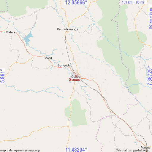
Gusau GPS coordinates[2]
12° 10' 12.864" North, 6° 39' 50.832" East
| Map corner | latitude | longitude |
|---|---|---|
| Upper-left | 12.85666°, | 5.961° |
| Center: | 12.17024°, | 6.66412° |
| Lower-right: | 11.48204°, | 7.36725° |
| Map W x H: | 152.8×152.8 km | = 94.9×94.9mi |
| max Lat: | 13.7543° ⇑13.4% North |
| Gusau: | 12.17024° |
| min Lat: | ⇓86.6% South 4.31231° |
| min Long | Gusau | max Long |
| 2.73333° | 6.66412° | 14.46552° |
| W 37.3%⇐ | ⇒62.7% E |
Elevation
Elevation of Gusau is 451 m = 1480 ft, and this is 154.5 m = 507 ft above average elevation for this country.
| Max E: |
1599 m = 5246 ft | 22.5% |
| Gusau | 451 m 1480 ft | |
| Avg. | 296.5 m = 973 ft | |
Min E: |
2 m = 7 ft | 77.5% |
See also: Gusau elevation on elevation.city.
Geographical zone
Gusau is located in North Torrid zone (between Equator and Tropic of Cancer). Distance of this Northern Tropic circle is 1252.7 km =778.4 mi to North.| Distance of | km | miles | from Gusau |
|---|---|---|---|
| North Pole | 8653.9 | 5377.3 | to North |
| Arctic Circle | 6048 | 3758.1 | to North |
| Tropic Cancer | 1252.7 | 778.4 | to North |
| Equator | 1353.2 | 840.8 | to South |


Nearby cities:
15 places around Gusau: (largest is in red/bold)
• Anka
80.4 km =50 mi,  265°
265°
• Birnin Magaji
50 km =31.1 mi,  30°
30°
• Bungudu
16.3 km =10.1 mi,  312°
312°
• Dan Musa
73.5 km =45.7 mi,  82°
82°
• Faskari
63.9 km =39.7 mi,  141°
141°
• Kaura Namoda
47.8 km =29.7 mi,  349°
349°
• Kwatarkwashi
17.5 km =10.9 mi,  100°
100°
• Maradun
63.5 km =39.5 mi, 314°
• Maru
33.6 km =20.9 mi,  302°
302°
• Moriki
80.6 km =50.1 mi, 346°
• Runka
76.6 km =47.6 mi,  66°
66°
• Sauri
51 km =31.7 mi,  165°
165°
• Talata Mafara
78.9 km =49 mi, 304°
• Tsafe
36.6 km =22.7 mi,  130°
130°
• Zurmi
68.7 km =42.7 mi,  10°
10°
Sources, notices
• [Note1] Compared only with cities in Nigeria existing in our database
• [Src1] Map data: © OpenStreetMap contributors (CC-BY-SA)
• [Src2] Other city data from geonames.org with taken over terms of usage.
• [Src3] Geographical zone / Annual Mean Temperature by Robert A. Rohde @ Wikipedia
