Gujba geodata
Gujba (Yobe) is a populated place; located in Nigeria in Africa/Lagos (GMT+1) time zone. With population of 11,359 people, there are 315 cities with bigger population in this country. Compared to other cities in Nigeria, 77.6% of cities are located further ↓South; 93.5% of cities are located further ←West and 73.5% of cities have lower elevation than Gujba. Note1


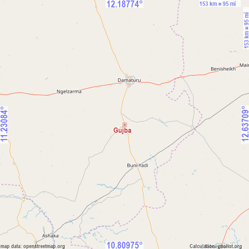
Gujba GPS coordinates[2]
11° 29' 58.524" North, 11° 56' 2.256" East
| Map corner | latitude | longitude |
|---|---|---|
| Upper-left | 12.18774°, | 11.23084° |
| Center: | 11.49959°, | 11.93396° |
| Lower-right: | 10.80975°, | 12.63709° |
| Map W x H: | 153.2×153.2 km | = 95.2×95.2mi |
| max Lat: | 13.7543° ⇑22.4% North |
| Gujba: | 11.49959° |
| min Lat: | ⇓77.6% South 4.31231° |
| min Long | Gujba | max Long |
| 2.73333° | 11.93396° | 14.46552° |
| W 93.5%⇐ | ⇒6.5% E |
Elevation
Elevation of Gujba is 420 m = 1378 ft, and this is 123.5 m = 405 ft above average elevation for this country.
| Max E: |
1599 m = 5246 ft | 26.5% |
| Gujba | 420 m 1378 ft | |
| Avg. | 296.5 m = 973 ft | |
Min E: |
2 m = 7 ft | 73.5% |
See also: Nigeria elevation on elevation.city.
Geographical zone
Gujba is located in North Torrid zone (between Equator and Tropic of Cancer). Distance of Equator is 1278.6 km =794.5 mi to South.| Distance of | km | miles | from Gujba |
|---|---|---|---|
| North Pole | 8728.4 | 5423.6 | to North |
| Arctic Circle | 6122.5 | 3804.3 | to North |
| Tropic Cancer | 1327.3 | 824.7 | to North |
| Equator | 1278.6 | 794.5 | to South |


Nearby cities:
15 places around Gujba: (largest is in red/bold)
• Babban Gida
75 km =46.6 mi,  346°
346°
• Bajoga
90.5 km =56.2 mi,  217°
217°
• Bara
68.4 km =42.5 mi,  203°
203°
• Benisheikh
69.8 km =43.4 mi,  60°
60°
• Buni Yadi
26.3 km =16.3 mi,  162°
162°
• Damagum
68.2 km =42.4 mi,  286°
286°
• Damaturu
27.7 km =17.2 mi,  6°
6°
• Dankalwa
38.6 km =24 mi,  45°
45°
• Daura
57.8 km =35.9 mi,  276°
276°
• Fika
72.2 km =44.9 mi,  250°
250°
• Goniri
41.3 km =25.7 mi,  92°
92°
• Lajere
75.8 km =47.1 mi,  314°
314°
• Miringa
88.5 km =55 mi, 164°
• Nafada
79.5 km =49.4 mi,  235°
235°
• Yajiwa
86.6 km =53.8 mi,  98°
98°
Sources, notices
• [Note1] Compared only with cities in Nigeria existing in our database
• [Src1] Map data: © OpenStreetMap contributors (CC-BY-SA)
• [Src2] Other city data from geonames.org with taken over terms of usage.
• [Src3] Geographical zone / Annual Mean Temperature by Robert A. Rohde @ Wikipedia
