Babban Gida geodata
Babban Gida (Yobe) is a seat of a second-order administrative division; located in Nigeria in Africa/Lagos (GMT+1) time zone. In our database, there are 451 cities with bigger population. Compared to other cities in Nigeria, 86.4% of cities are located further ↓South; 92.9% of cities are located further ←West and 62% of cities have lower elevation than Babban Gida. Note1


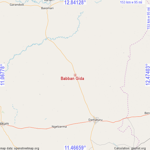
Babban Gida GPS coordinates[2]
12° 9' 17.352" North, 11° 46' 15.24" East
| Map corner | latitude | longitude |
|---|---|---|
| Upper-left | 12.84128°, | 11.06778° |
| Center: | 12.15482°, | 11.7709° |
| Lower-right: | 11.46659°, | 12.47403° |
| Map W x H: | 152.9×152.9 km | = 95×95mi |
| max Lat: | 13.7543° ⇑13.6% North |
| Babban Gida: | 12.15482° |
| min Lat: | ⇓86.4% South 4.31231° |
| min Long | Babban Gida | max Long |
| 2.73333° | 11.7709° | 14.46552° |
| W 92.9%⇐ | ⇒7.1% E |
Elevation
Elevation of Babban Gida is 355 m = 1165 ft, and this is 58.5 m = 192 ft above average elevation for this country.
| Max E: |
1599 m = 5246 ft | 38% |
| Babban Gida | 355 m 1165 ft | |
| Avg. | 296.5 m = 973 ft | |
Min E: |
2 m = 7 ft | 62% |
See also: Nigeria elevation on elevation.city.
Geographical zone
Babban Gida is located in North Torrid zone (between Equator and Tropic of Cancer). Distance of this Northern Tropic circle is 1254.4 km =779.4 mi to North.| Distance of | km | miles | from Babban Gida |
|---|---|---|---|
| North Pole | 8655.6 | 5378.3 | to North |
| Arctic Circle | 6049.7 | 3759.1 | to North |
| Tropic Cancer | 1254.4 | 779.4 | to North |
| Equator | 1351.5 | 839.8 | to South |


Nearby cities:
15 places around Babban Gida: (largest is in red/bold)
• Benisheikh
87.3 km =54.2 mi,  116°
116°
• Bornu Yassu
87.7 km =54.5 mi,  81°
81°
• Buni Yadi
101.3 km =62.9 mi,  165°
165°
• Damagum
71.1 km =44.2 mi,  221°
221°
• Damaturu
49.8 km =30.9 mi,  155°
155°
• Dankalwa
64.1 km =39.8 mi,  135°
135°
• Dapchi
48 km =29.8 mi,  322°
322°
• Daura
77.7 km =48.3 mi,  210°
210°
• Geidam
83.9 km =52.1 mi,  11°
11°
• Goniri
95 km =59 mi, 141°
• Gujba
75 km =46.6 mi, 166°
• Gwio Kura
95.8 km =59.5 mi,  307°
307°
• Lajere
40.9 km =25.4 mi,  241°
241°
• Potiskum
89.6 km =55.7 mi, 236°
• Sabon Garin Nangere
83.1 km =51.6 mi,  245°
245°
Sources, notices
• [Note1] Compared only with cities in Nigeria existing in our database
• [Src1] Map data: © OpenStreetMap contributors (CC-BY-SA)
• [Src2] Other city data from geonames.org with taken over terms of usage.
• [Src3] Geographical zone / Annual Mean Temperature by Robert A. Rohde @ Wikipedia
