Gada geodata
Gada (Sokoto) is a seat of a second-order administrative division; located in Nigeria in Africa/Lagos (GMT+1) time zone. In our database, there are 451 cities with bigger population. Compared to other cities in Nigeria, 100% of cities are located further ↓South; 74.4% of cities are located further →East and 55.7% of cities have lower elevation than Gada. Note1


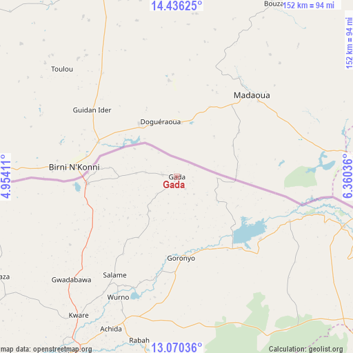
Gada GPS coordinates[2]
13° 45' 15.48" North, 5° 39' 26.028" East
| Map corner | latitude | longitude |
|---|---|---|
| Upper-left | 14.43625°, | 4.95411° |
| Center: | 13.7543°, | 5.65723° |
| Lower-right: | 13.07036°, | 6.36036° |
| Map W x H: | 151.9×151.9 km | = 94.4×94.4mi |
| max Lat: | 13.7543° ⇑0% North |
| Gada: | 13.7543° |
| min Lat: | ⇓100% South 4.31231° |
| min Long | Gada | max Long |
| 2.73333° | 5.65723° | 14.46552° |
| W 25.6%⇐ | ⇒74.4% E |
Elevation
Elevation of Gada is 316 m = 1037 ft, and this is 19.5 m = 64 ft above average elevation for this country.
| Max E: |
1599 m = 5246 ft | 44.3% |
| Gada | 316 m 1037 ft | |
| Avg. | 296.5 m = 973 ft | |
Min E: |
2 m = 7 ft | 55.7% |
See also: Nigeria elevation on elevation.city.
Geographical zone
Gada is located in North Torrid zone (between Equator and Tropic of Cancer). Distance of this Northern Tropic circle is 1076.6 km =669 mi to North.| Distance of | km | miles | from Gada |
|---|---|---|---|
| North Pole | 8477.7 | 5267.8 | to North |
| Arctic Circle | 5871.8 | 3648.6 | to North |
| Tropic Cancer | 1076.6 | 669 | to North |
| Equator | 1529.3 | 950.3 | to South |


Nearby cities:
15 places around Gada: (largest is in red/bold)
• Balle
110.1 km =68.4 mi,  253°
253°
• Binji
100.2 km =62.3 mi,  233°
233°
• Dange
105.7 km =65.7 mi,  198°
198°
• Gandi
88.4 km =54.9 mi,  173°
173°
• Gidan Madi
89.7 km =55.7 mi,  235°
235°
• Goronyo
34.7 km =21.6 mi,  177°
177°
• Gwadabawa
63.2 km =39.3 mi, 225°
• Illela
38.9 km =24.2 mi,  266°
266°
• Isa
101.6 km =63.1 mi,  127°
127°
• Kware
73 km =45.4 mi,  215°
215°
• Rabah
72.1 km =44.8 mi,  192°
192°
• Sabon Birni
75 km =46.6 mi,  106°
106°
• Sokoto
89 km =55.3 mi,  210°
210°
• Wamako
100.3 km =62.3 mi, 216°
• Wurno
57.4 km =35.7 mi, 206°
Sources, notices
• [Note1] Compared only with cities in Nigeria existing in our database
• [Src1] Map data: © OpenStreetMap contributors (CC-BY-SA)
• [Src2] Other city data from geonames.org with taken over terms of usage.
• [Src3] Geographical zone / Annual Mean Temperature by Robert A. Rohde @ Wikipedia
