Elele geodata
Elele (Rivers) is a populated place; located in Nigeria in Africa/Lagos (GMT+1) time zone. With population of 20,620 people, there are 198 cities with bigger population in this country. Compared to other cities in Nigeria, 93.4% of cities are located further ↑North; 60.3% of cities are located further →East and 89.8% of cities have higher elevation than Elele. Note1


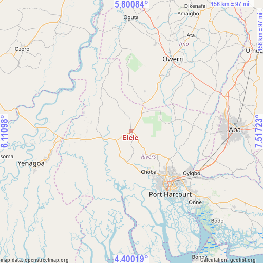
Elele GPS coordinates[2]
5° 6' 3.24" North, 6° 48' 50.796" East
| Map corner | latitude | longitude |
|---|---|---|
| Upper-left | 5.80084°, | 6.11098° |
| Center: | 5.1009°, | 6.81411° |
| Lower-right: | 4.40019°, | 7.51723° |
| Map W x H: | 155.7×155.7 km | = 96.7×96.7mi |
| max Lat: | 13.7543° ⇑93.4% North |
| Elele: | 5.1009° |
| min Lat: | ⇓6.6% South 4.31231° |
| min Long | Elele | max Long |
| 2.73333° | 6.81411° | 14.46552° |
| W 39.7%⇐ | ⇒60.3% E |
Elevation
Elevation of Elele is 32 m = 105 ft, and this is 264.5 m = 868 ft below average elevation for this country.
| Max E: |
1599 m = 5246 ft | 89.8% |
| Avg. | 296.5 m = 973 ft | |
| Elele | 32 m = 105 ft | |
Min E: |
2 m = 7 ft | 10.2% |
See also: Nigeria elevation on elevation.city.
Geographical zone
Elele is located in North Torrid zone (between Equator and Tropic of Cancer). Distance of Equator is 567.2 km =352.4 mi to South.| Distance of | km | miles | from Elele |
|---|---|---|---|
| North Pole | 9439.9 | 5865.7 | to North |
| Arctic Circle | 6834 | 4246.4 | to North |
| Tropic Cancer | 2038.8 | 1266.9 | to North |
| Equator | 567.2 | 352.4 | to South |


Nearby cities:
15 places around Elele: (largest is in red/bold)
• Abonnema
41.3 km =25.7 mi,  186°
186°
• Abua
32.9 km =20.4 mi,  214°
214°
• Ahoada
18.3 km =11.4 mi,  263°
263°
• Akinima
38.6 km =24 mi,  267°
267°
• Buguma
40.9 km =25.4 mi,  172°
172°
• Degema
39.6 km =24.6 mi, 187°
• Degema Hulk
38.4 km =23.9 mi, 190°
• Emuoha
24.6 km =15.3 mi, 168°
• Isiokpo
12.7 km =7.9 mi,  149°
149°
• Obonoma
43.4 km =27 mi,  183°
183°
• Okehi
36.2 km =22.5 mi,  83°
83°
• Omoku
32.1 km =19.9 mi,  327°
327°
• Port Harcourt
42.2 km =26.2 mi, 148°
• Rumuodomaya
31.1 km =19.3 mi,  137°
137°
• Umuguma
44.1 km =27.4 mi,  22°
22°
Sources, notices
• [Note1] Compared only with cities in Nigeria existing in our database
• [Src1] Map data: © OpenStreetMap contributors (CC-BY-SA)
• [Src2] Other city data from geonames.org with taken over terms of usage.
• [Src3] Geographical zone / Annual Mean Temperature by Robert A. Rohde @ Wikipedia
