Effraya geodata
Effraya (Cross River) is a seat of a second-order administrative division; located in Nigeria in Africa/Lagos (GMT+1) time zone. In our database, there are 451 cities with bigger population. Compared to other cities in Nigeria, 85.4% of cities are located further ↑North; 73.9% of cities are located further ←West and 83.2% of cities have higher elevation than Effraya. Note1


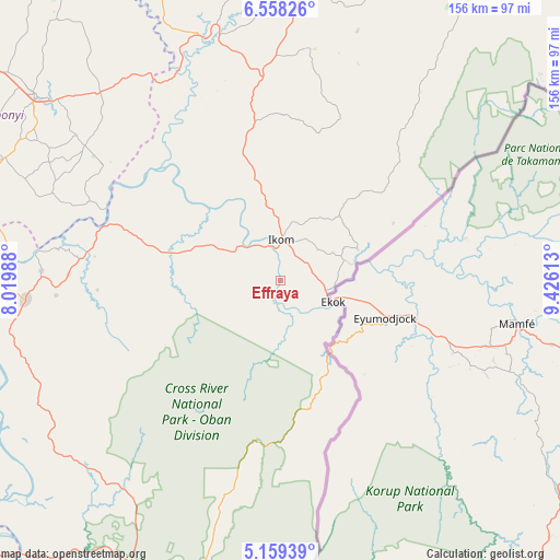
Effraya GPS coordinates[2]
5° 51' 33.336" North, 8° 43' 22.836" East
| Map corner | latitude | longitude |
|---|---|---|
| Upper-left | 6.55826°, | 8.01988° |
| Center: | 5.85926°, | 8.72301° |
| Lower-right: | 5.15939°, | 9.42613° |
| Map W x H: | 155.5×155.5 km | = 96.6×96.6mi |
| max Lat: | 13.7543° ⇑85.4% North |
| Effraya: | 5.85926° |
| min Lat: | ⇓14.6% South 4.31231° |
| min Long | Effraya | max Long |
| 2.73333° | 8.72301° | 14.46552° |
| W 73.9%⇐ | ⇒26.1% E |
Elevation
Elevation of Effraya is 66 m = 217 ft, and this is 230.5 m = 756 ft below average elevation for this country.
| Max E: |
1599 m = 5246 ft | 83.2% |
| Avg. | 296.5 m = 973 ft | |
| Effraya | 66 m = 217 ft | |
Min E: |
2 m = 7 ft | 16.8% |
See also: Nigeria elevation on elevation.city.
Geographical zone
Effraya is located in North Torrid zone (between Equator and Tropic of Cancer). Distance of Equator is 651.5 km =404.8 mi to South.| Distance of | km | miles | from Effraya |
|---|---|---|---|
| North Pole | 9355.6 | 5813.3 | to North |
| Arctic Circle | 6749.7 | 4194.1 | to North |
| Tropic Cancer | 1954.4 | 1214.4 | to North |
| Equator | 651.5 | 404.8 | to South |


Nearby cities:
15 places around Effraya: (largest is in red/bold)
• Abakaliki
85 km =52.8 mi,  307°
307°
• Afikpo
87.2 km =54.2 mi,  272°
272°
• Akamkpa
73.2 km =45.5 mi,  213°
213°
• Akpet Central
73.7 km =45.8 mi,  248°
248°
• Boje
52.1 km =32.4 mi,  24°
24°
• Iboko
81.5 km =50.6 mi,  318°
318°
• Ikom
12.1 km =7.5 mi,  351°
351°
• Itigidi
77.6 km =48.2 mi, 272°
• Obubra
49.5 km =30.8 mi,  299°
299°
• Odukpani
91.2 km =56.7 mi, 207°
• Ogoja
89.3 km =55.5 mi,  5°
5°
• Okpoma
82.6 km =51.3 mi, 353°
• Onuebonyi Echara
68.4 km =42.5 mi,  292°
292°
• Onueke
82.7 km =51.4 mi, 293°
• Ugep
71.2 km =44.2 mi, 265°
Sources, notices
• [Note1] Compared only with cities in Nigeria existing in our database
• [Src1] Map data: © OpenStreetMap contributors (CC-BY-SA)
• [Src2] Other city data from geonames.org with taken over terms of usage.
• [Src3] Geographical zone / Annual Mean Temperature by Robert A. Rohde @ Wikipedia
