Agaie geodata
Agaie (Niger) is a seat of a second-order administrative division; located in Nigeria in Africa/Lagos (GMT+1) time zone. With population of 11,742 people, there are 300 cities with bigger population in this country. Compared to other cities in Nigeria, 54.9% of cities are located further ↓South; 66.3% of cities are located further →East and 75% of cities have higher elevation than Agaie. Note1


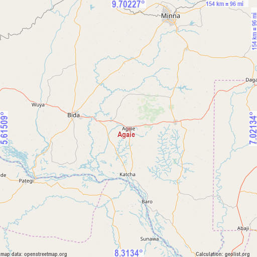
Agaie GPS coordinates[2]
9° 0' 30.6" North, 6° 19' 5.556" East
| Map corner | latitude | longitude |
|---|---|---|
| Upper-left | 9.70227°, | 5.61509° |
| Center: | 9.0085°, | 6.31821° |
| Lower-right: | 8.3134°, | 7.02134° |
| Map W x H: | 154.4×154.4 km | = 95.9×95.9mi |
| max Lat: | 13.7543° ⇑45.1% North |
| Agaie: | 9.0085° |
| min Lat: | ⇓54.9% South 4.31231° |
| min Long | Agaie | max Long |
| 2.73333° | 6.31821° | 14.46552° |
| W 33.7%⇐ | ⇒66.3% E |
Elevation
Elevation of Agaie is 120 m = 394 ft, and this is 176.5 m = 579 ft below average elevation for this country.
| Max E: |
1599 m = 5246 ft | 75% |
| Avg. | 296.5 m = 973 ft | |
| Agaie | 120 m = 394 ft | |
Min E: |
2 m = 7 ft | 25% |
See also: Nigeria elevation on elevation.city.
Geographical zone
Agaie is located in North Torrid zone (between Equator and Tropic of Cancer). Distance of Equator is 1001.7 km =622.4 mi to South.| Distance of | km | miles | from Agaie |
|---|---|---|---|
| North Pole | 9005.4 | 5595.7 | to North |
| Arctic Circle | 6399.5 | 3976.5 | to North |
| Tropic Cancer | 1604.3 | 996.9 | to North |
| Equator | 1001.7 | 622.4 | to South |


Nearby cities:
15 places around Agaie: (largest is in red/bold)
• Badeggi
20 km =12.4 mi,  285°
285°
• Baro
45 km =28 mi,  165°
165°
• Bida
34.8 km =21.6 mi,  283°
283°
• Gawu Babangida
80 km =49.7 mi,  67°
67°
• Gwagwalada
84.2 km =52.3 mi,  94°
94°
• Katcha
27.6 km =17.1 mi,  181°
181°
• Kutigi
82.2 km =51.1 mi, 285°
• Kwali
78.2 km =48.6 mi,  100°
100°
• Lapai
28 km =17.4 mi,  81°
81°
• Lemu
53.6 km =33.3 mi,  323°
323°
• Maikunkele
77.2 km =48 mi,  13°
13°
• Minna
72 km =44.7 mi,  20°
20°
• Paiko
58.9 km =36.6 mi,  36°
36°
• Patigi
69.2 km =43 mi,  243°
243°
• Wushishi
84.6 km =52.6 mi,  341°
341°
Sources, notices
• [Note1] Compared only with cities in Nigeria existing in our database
• [Src1] Map data: © OpenStreetMap contributors (CC-BY-SA)
• [Src2] Other city data from geonames.org with taken over terms of usage.
• [Src3] Geographical zone / Annual Mean Temperature by Robert A. Rohde @ Wikipedia
