Lemu geodata
Lemu (Niger) is a seat of a second-order administrative division; located in Nigeria in Africa/Lagos (GMT+1) time zone. In our database, there are 451 cities with bigger population. Compared to other cities in Nigeria, 58.7% of cities are located further ↓South; 70.3% of cities are located further →East and 71.6% of cities have higher elevation than Lemu. Note1


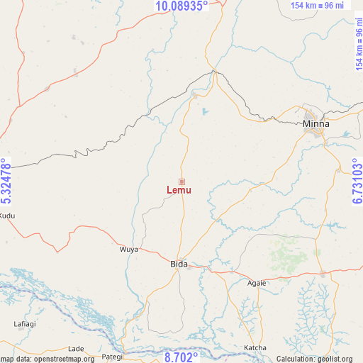
Lemu GPS coordinates[2]
9° 23' 46.932" North, 6° 1' 40.476" East
| Map corner | latitude | longitude |
|---|---|---|
| Upper-left | 10.08935°, | 5.32478° |
| Center: | 9.39637°, | 6.02791° |
| Lower-right: | 8.702°, | 6.73103° |
| Map W x H: | 154.3×154.3 km | = 95.9×95.9mi |
| max Lat: | 13.7543° ⇑41.3% North |
| Lemu: | 9.39637° |
| min Lat: | ⇓58.7% South 4.31231° |
| min Long | Lemu | max Long |
| 2.73333° | 6.02791° | 14.46552° |
| W 29.7%⇐ | ⇒70.3% E |
Elevation
Elevation of Lemu is 139 m = 456 ft, and this is 157.5 m = 517 ft below average elevation for this country.
| Max E: |
1599 m = 5246 ft | 71.6% |
| Avg. | 296.5 m = 973 ft | |
| Lemu | 139 m = 456 ft | |
Min E: |
2 m = 7 ft | 28.4% |
See also: Nigeria elevation on elevation.city.
Geographical zone
Lemu is located in North Torrid zone (between Equator and Tropic of Cancer). Distance of Equator is 1044.8 km =649.2 mi to South.| Distance of | km | miles | from Lemu |
|---|---|---|---|
| North Pole | 8962.3 | 5568.9 | to North |
| Arctic Circle | 6356.4 | 3949.7 | to North |
| Tropic Cancer | 1561.1 | 970 | to North |
| Equator | 1044.8 | 649.2 | to South |


Nearby cities:
15 places around Lemu: (largest is in red/bold)
• Agaie
53.6 km =33.3 mi,  143°
143°
• Badeggi
39.9 km =24.8 mi,  161°
161°
• Bida
35.2 km =21.9 mi,  183°
183°
• Enagi
61 km =37.9 mi,  240°
240°
• Katcha
77.3 km =48 mi, 156°
• Kutigi
52.2 km =32.4 mi,  245°
245°
• Lapai
71.3 km =44.3 mi,  123°
123°
• Maikunkele
58.9 km =36.6 mi,  57°
57°
• Mashegu
69.6 km =43.2 mi,  336°
336°
• Minna
62 km =38.5 mi,  66°
66°
• Paiko
66.6 km =41.4 mi,  86°
86°
• Patigi
80.1 km =49.8 mi,  201°
201°
• Tegina
77.1 km =47.9 mi,  13°
13°
• Wushishi
37.5 km =23.3 mi, 7°
• Zungeru
47.7 km =29.6 mi,  16°
16°
Sources, notices
• [Note1] Compared only with cities in Nigeria existing in our database
• [Src1] Map data: © OpenStreetMap contributors (CC-BY-SA)
• [Src2] Other city data from geonames.org with taken over terms of usage.
• [Src3] Geographical zone / Annual Mean Temperature by Robert A. Rohde @ Wikipedia
