Katcha geodata
Katcha (Niger) is a seat of a second-order administrative division; located in Nigeria in Africa/Lagos (GMT+1) time zone. In our database, there are 451 cities with bigger population. Compared to other cities in Nigeria, 52.8% of cities are located further ↓South; 66.5% of cities are located further →East and 82.5% of cities have higher elevation than Katcha. Note1


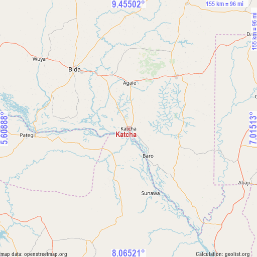
Katcha GPS coordinates[2]
8° 45' 38.736" North, 6° 18' 43.2" East
| Map corner | latitude | longitude |
|---|---|---|
| Upper-left | 9.45502°, | 5.60888° |
| Center: | 8.76076°, | 6.312° |
| Lower-right: | 8.06521°, | 7.01513° |
| Map W x H: | 154.5×154.5 km | = 96×96mi |
| max Lat: | 13.7543° ⇑47.2% North |
| Katcha: | 8.76076° |
| min Lat: | ⇓52.8% South 4.31231° |
| min Long | Katcha | max Long |
| 2.73333° | 6.312° | 14.46552° |
| W 33.5%⇐ | ⇒66.5% E |
Elevation
Elevation of Katcha is 71 m = 233 ft, and this is 225.5 m = 740 ft below average elevation for this country.
| Max E: |
1599 m = 5246 ft | 82.5% |
| Avg. | 296.5 m = 973 ft | |
| Katcha | 71 m = 233 ft | |
Min E: |
2 m = 7 ft | 17.5% |
See also: Nigeria elevation on elevation.city.
Geographical zone
Katcha is located in North Torrid zone (between Equator and Tropic of Cancer). Distance of Equator is 974.1 km =605.3 mi to South.| Distance of | km | miles | from Katcha |
|---|---|---|---|
| North Pole | 9033 | 5612.8 | to North |
| Arctic Circle | 6427.1 | 3993.6 | to North |
| Tropic Cancer | 1631.8 | 1014 | to North |
| Equator | 974.1 | 605.3 | to South |


Nearby cities:
15 places around Katcha: (largest is in red/bold)
• Abaji
76.5 km =47.5 mi,  114°
114°
• Agaie
27.6 km =17.1 mi,  1°
1°
• Badeggi
37.7 km =23.4 mi,  330°
330°
• Baro
19.9 km =12.4 mi,  144°
144°
• Bida
48.6 km =30.2 mi,  316°
316°
• Gwagwalada
87 km =54.1 mi,  76°
76°
• Isanlu
75.5 km =46.9 mi,  225°
225°
• Isanlu-Itedoijowa
75.3 km =46.8 mi,  224°
224°
• Koton-Karfe
91.6 km =56.9 mi, 144°
• Kwali
78.8 km =49 mi, 80°
• Lapai
42.5 km =26.4 mi,  42°
42°
• Lemu
77.3 km =48 mi,  336°
336°
• Mopa
86.4 km =53.7 mi,  212°
212°
• Paiko
83.1 km =51.6 mi,  25°
25°
• Patigi
61.3 km =38.1 mi,  266°
266°
Sources, notices
• [Note1] Compared only with cities in Nigeria existing in our database
• [Src1] Map data: © OpenStreetMap contributors (CC-BY-SA)
• [Src2] Other city data from geonames.org with taken over terms of usage.
• [Src3] Geographical zone / Annual Mean Temperature by Robert A. Rohde @ Wikipedia
