Baro geodata
Baro (Niger) is a populated place; located in Nigeria in Africa/Lagos (GMT+1) time zone. With population of 26,821 people, there are 168 cities with bigger population in this country. Compared to other cities in Nigeria, 51.6% of cities are located further ↓South; 65.5% of cities are located further →East and 77.8% of cities have higher elevation than Baro. Note1


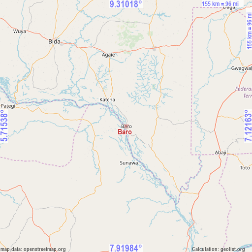
Baro GPS coordinates[2]
8° 36' 56.34" North, 6° 25' 6.6" East
| Map corner | latitude | longitude |
|---|---|---|
| Upper-left | 9.31018°, | 5.71538° |
| Center: | 8.61565°, | 6.4185° |
| Lower-right: | 7.91984°, | 7.12163° |
| Map W x H: | 154.6×154.6 km | = 96.1×96.1mi |
| max Lat: | 13.7543° ⇑48.4% North |
| Baro: | 8.61565° |
| min Lat: | ⇓51.6% South 4.31231° |
| min Long | Baro | max Long |
| 2.73333° | 6.4185° | 14.46552° |
| W 34.5%⇐ | ⇒65.5% E |
Elevation
Elevation of Baro is 94 m = 308 ft, and this is 202.5 m = 664 ft below average elevation for this country.
| Max E: |
1599 m = 5246 ft | 77.8% |
| Avg. | 296.5 m = 973 ft | |
| Baro | 94 m = 308 ft | |
Min E: |
2 m = 7 ft | 22.2% |
See also: Nigeria elevation on elevation.city.
Geographical zone
Baro is located in North Torrid zone (between Equator and Tropic of Cancer). Distance of Equator is 958 km =595.3 mi to South.| Distance of | km | miles | from Baro |
|---|---|---|---|
| North Pole | 9049.1 | 5622.8 | to North |
| Arctic Circle | 6443.2 | 4003.6 | to North |
| Tropic Cancer | 1647.9 | 1024 | to North |
| Equator | 958 | 595.3 | to South |


Nearby cities:
15 places around Baro: (largest is in red/bold)
• Abaji
60 km =37.3 mi,  105°
105°
• Agaie
45 km =28 mi,  345°
345°
• Badeggi
57.6 km =35.8 mi,  328°
328°
• Bida
68.5 km =42.6 mi,  319°
319°
• Gwagwalada
81.5 km =50.6 mi,  63°
63°
• Isanlu
75.4 km =46.9 mi,  241°
241°
• Isanlu-Itedoijowa
74.5 km =46.3 mi, 239°
• Katcha
19.9 km =12.4 mi, 324°
• Koton-Karfe
71.7 km =44.6 mi,  144°
144°
• Kuje
93.6 km =58.2 mi,  71°
71°
• Kwali
72.4 km =45 mi, 65°
• Lapai
50.5 km =31.4 mi,  19°
19°
• Mopa
81.1 km =50.4 mi,  225°
225°
• Patigi
73.9 km =45.9 mi,  279°
279°
• Toto
76.8 km =47.7 mi, 109°
Sources, notices
• [Note1] Compared only with cities in Nigeria existing in our database
• [Src1] Map data: © OpenStreetMap contributors (CC-BY-SA)
• [Src2] Other city data from geonames.org with taken over terms of usage.
• [Src3] Geographical zone / Annual Mean Temperature by Robert A. Rohde @ Wikipedia
