Mashegu geodata
Mashegu (Niger) is a seat of a second-order administrative division; located in Nigeria in Africa/Lagos (GMT+1) time zone. In our database, there are 451 cities with bigger population. Compared to other cities in Nigeria, 64.1% of cities are located further ↓South; 72.9% of cities are located further →East and 69.5% of cities have higher elevation than Mashegu. Note1


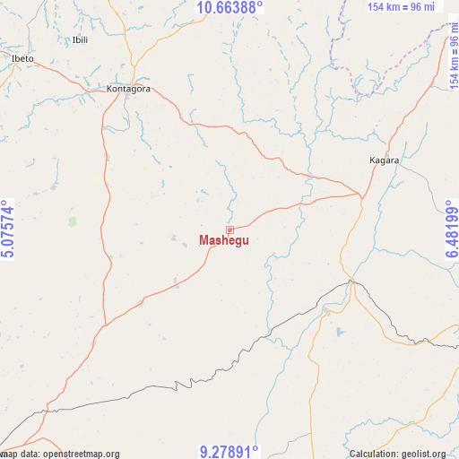
Mashegu GPS coordinates[2]
9° 58' 19.668" North, 5° 46' 43.896" East
| Map corner | latitude | longitude |
|---|---|---|
| Upper-left | 10.66388°, | 5.07574° |
| Center: | 9.97213°, | 5.77886° |
| Lower-right: | 9.27891°, | 6.48199° |
| Map W x H: | 154×154 km | = 95.7×95.7mi |
| max Lat: | 13.7543° ⇑35.9% North |
| Mashegu: | 9.97213° |
| min Lat: | ⇓64.1% South 4.31231° |
| min Long | Mashegu | max Long |
| 2.73333° | 5.77886° | 14.46552° |
| W 27.1%⇐ | ⇒72.9% E |
Elevation
Elevation of Mashegu is 151 m = 495 ft, and this is 145.5 m = 477 ft below average elevation for this country.
| Max E: |
1599 m = 5246 ft | 69.5% |
| Avg. | 296.5 m = 973 ft | |
| Mashegu | 151 m = 495 ft | |
Min E: |
2 m = 7 ft | 30.5% |
See also: Nigeria elevation on elevation.city.
Geographical zone
Mashegu is located in North Torrid zone (between Equator and Tropic of Cancer). Distance of Equator is 1108.8 km =689 mi to South.| Distance of | km | miles | from Mashegu |
|---|---|---|---|
| North Pole | 8898.3 | 5529.1 | to North |
| Arctic Circle | 6292.4 | 3909.9 | to North |
| Tropic Cancer | 1497.1 | 930.3 | to North |
| Equator | 1108.8 | 689 | to South |


Nearby cities:
15 places around Mashegu: (largest is in red/bold)
• Bangi
95.9 km =59.6 mi,  3°
3°
• Bokani
87.3 km =54.2 mi,  226°
226°
• Enagi
97.4 km =60.5 mi,  195°
195°
• Ibeto
89.8 km =55.8 mi,  309°
309°
• Kagara
57.3 km =35.6 mi,  65°
65°
• Kontagora
58.6 km =36.4 mi,  324°
324°
• Kusheriki
95.7 km =59.5 mi,  49°
49°
• Kutigi
88.1 km =54.7 mi,  193°
193°
• Lemu
69.6 km =43.2 mi,  156°
156°
• Maikunkele
83.1 km =51.6 mi,  112°
112°
• Minna
93.1 km =57.8 mi,  115°
115°
• Tegina
46.4 km =28.8 mi,  76°
76°
• Ukata
95.7 km =59.5 mi, 3°
• Wushishi
42 km =26.1 mi,  129°
129°
• Zungeru
44.8 km =27.8 mi, 114°
Sources, notices
• [Note1] Compared only with cities in Nigeria existing in our database
• [Src1] Map data: © OpenStreetMap contributors (CC-BY-SA)
• [Src2] Other city data from geonames.org with taken over terms of usage.
• [Src3] Geographical zone / Annual Mean Temperature by Robert A. Rohde @ Wikipedia
