Zungeru geodata
Zungeru (Niger) is a populated place; located in Nigeria in Africa/Lagos (GMT+1) time zone. With population of 24,447 people, there are 178 cities with bigger population in this country. Compared to other cities in Nigeria, 62.3% of cities are located further ↓South; 68.8% of cities are located further →East and 74.3% of cities have higher elevation than Zungeru. Note1


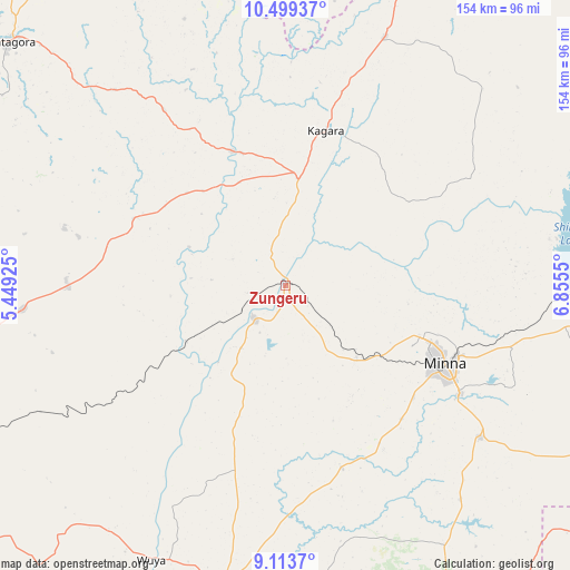
Zungeru GPS coordinates[2]
9° 48' 26.136" North, 6° 9' 8.568" East
| Map corner | latitude | longitude |
|---|---|---|
| Upper-left | 10.49937°, | 5.44925° |
| Center: | 9.80726°, | 6.15238° |
| Lower-right: | 9.1137°, | 6.8555° |
| Map W x H: | 154.1×154.1 km | = 95.8×95.8mi |
| max Lat: | 13.7543° ⇑37.7% North |
| Zungeru: | 9.80726° |
| min Lat: | ⇓62.3% South 4.31231° |
| min Long | Zungeru | max Long |
| 2.73333° | 6.15238° | 14.46552° |
| W 31.2%⇐ | ⇒68.8% E |
Elevation
Elevation of Zungeru is 125 m = 410 ft, and this is 171.5 m = 563 ft below average elevation for this country.
| Max E: |
1599 m = 5246 ft | 74.3% |
| Avg. | 296.5 m = 973 ft | |
| Zungeru | 125 m = 410 ft | |
Min E: |
2 m = 7 ft | 25.7% |
See also: Nigeria elevation on elevation.city.
Geographical zone
Zungeru is located in North Torrid zone (between Equator and Tropic of Cancer). Distance of Equator is 1090.5 km =677.6 mi to South.| Distance of | km | miles | from Zungeru |
|---|---|---|---|
| North Pole | 8916.6 | 5540.5 | to North |
| Arctic Circle | 6310.7 | 3921.3 | to North |
| Tropic Cancer | 1515.5 | 941.7 | to North |
| Equator | 1090.5 | 677.6 | to South |


Nearby cities:
15 places around Zungeru: (largest is in red/bold)
• Agaie
90.7 km =56.4 mi,  168°
168°
• Badeggi
83.5 km =51.9 mi,  180°
180°
• Bida
82.3 km =51.1 mi,  190°
190°
• Kagara
43.6 km =27.1 mi,  14°
14°
• Kusheriki
86.7 km =53.9 mi,  21°
21°
• Kuta
61.5 km =38.2 mi,  83°
83°
• Kutigi
91 km =56.5 mi,  222°
222°
• Lapai
96.4 km =59.9 mi,  151°
151°
• Lemu
47.7 km =29.6 mi,  196°
196°
• Maikunkele
38.3 km =23.8 mi,  110°
110°
• Mashegu
44.8 km =27.8 mi,  294°
294°
• Minna
48.3 km =30 mi,  116°
116°
• Paiko
66.9 km =41.6 mi,  127°
127°
• Tegina
29.6 km =18.4 mi, 8°
• Wushishi
12.2 km =7.6 mi,  225°
225°
Sources, notices
• [Note1] Compared only with cities in Nigeria existing in our database
• [Src1] Map data: © OpenStreetMap contributors (CC-BY-SA)
• [Src2] Other city data from geonames.org with taken over terms of usage.
• [Src3] Geographical zone / Annual Mean Temperature by Robert A. Rohde @ Wikipedia
