Spierdijk geodata
Spierdijk (North Holland) is a populated place; located in Netherlands in Europe/Amsterdam (GMT+2) time zone. With population of 1,585 people, there are 1092 cities with bigger population in this country. Compared to other cities in Netherlands, 74.7% of cities are located further ↓South; 75% of cities are located further →East and 96.1% of cities have higher elevation than Spierdijk. Note1


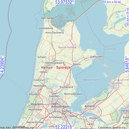
Spierdijk GPS coordinates[2]
52° 39' 2.988" North, 4° 56' 35.016" East
| Map corner | latitude | longitude |
|---|---|---|
| Upper-left | 53.07532°, | 4.23994° |
| Center: | 52.65083°, | 4.94306° |
| Lower-right: | 52.22218°, | 5.64619° |
| Map W x H: | 94.9×94.9 km | = 59×59mi |
| max Lat: | 53.48025° ⇑25.3% North |
| Spierdijk: | 52.65083° |
| min Lat: | ⇓74.7% South 50.76917° |
| min Long | Spierdijk | max Long |
| 3.38611° | 4.94306° | 7.16528° |
| W 25%⇐ | ⇒75% E |
Elevation
Elevation of Spierdijk is -1 m = -3 ft, and this is 16 m = 52 ft below average elevation for this country.
| Max E: |
203 m = 666 ft | 96.1% |
| Avg. | 15 m = 49 ft | |
| Spierdijk | -1 m = -3 ft | |
Min E: |
-6 m = -20 ft | 3.9% |
See also: Netherlands elevation on elevation.city.
Geographical zone
Spierdijk is located in North temperate zone (between Tropic of Cancer and the Arctic Circle). Distance of this North polar circle is 1547 km =961.3 mi to North.| Distance of | km | miles | from Spierdijk |
|---|---|---|---|
| North Pole | 4152.8 | 2580.4 | to North |
| Arctic Circle | 1547 | 961.3 | to North |
| Tropic Cancer | 3248.3 | 2018.4 | to South |
| Equator | 5854.2 | 3637.6 | to South |


Nearby cities:
15 places around Spierdijk: (largest is in red/bold)
• Avenhorn
3.7 km =2.3 mi,  171°
171°
• Beets
7.3 km =4.5 mi,  161°
161°
• Berkhout
4.1 km =2.5 mi,  105°
105°
• De Goorn
2.8 km =1.7 mi, 174°
• De Noord
8.8 km =5.5 mi,  315°
315°
• De Weere
9.1 km =5.7 mi,  22°
22°
• Heerhugowaard
6.8 km =4.2 mi,  289°
289°
• Hensbroek
4 km =2.5 mi,  281°
281°
• Hoogwoud
7.2 km =4.5 mi,  357°
357°
• Hoorn
7.9 km =4.9 mi,  96°
96°
• Obdam
3.7 km =2.3 mi, 318°
• Opmeer
6.2 km =3.9 mi,  0°
0°
• Oterleek
7.5 km =4.7 mi,  257°
257°
• Schermerhorn
6.6 km =4.1 mi,  211°
211°
• Zwaagdijk-West
8 km =5 mi,  70°
70°
Sources, notices
• [Note1] Compared only with cities in Netherlands existing in our database
• [Src1] Map data: © OpenStreetMap contributors (CC-BY-SA)
• [Src2] Other city data from geonames.org with taken over terms of usage.
• [Src3] Geographical zone / Annual Mean Temperature by Robert A. Rohde @ Wikipedia
