Avenhorn geodata
Avenhorn (North Holland) is a populated place; located in Netherlands in Europe/Amsterdam (GMT+2) time zone. With population of 2,945 people, there are 764 cities with bigger population in this country. Compared to other cities in Netherlands, 74.1% of cities are located further ↓South; 74.7% of cities are located further →East and 98.2% of cities have higher elevation than Avenhorn. Note1


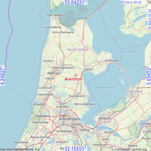
Avenhorn GPS coordinates[2]
52° 37' 3" North, 4° 57' 5.004" East
| Map corner | latitude | longitude |
|---|---|---|
| Upper-left | 53.04231°, | 4.24827° |
| Center: | 52.6175°, | 4.95139° |
| Lower-right: | 52.18853°, | 5.65452° |
| Map W x H: | 94.9×94.9 km | = 59×59mi |
| max Lat: | 53.48025° ⇑25.9% North |
| Avenhorn: | 52.6175° |
| min Lat: | ⇓74.1% South 50.76917° |
| min Long | Avenhorn | max Long |
| 3.38611° | 4.95139° | 7.16528° |
| W 25.3%⇐ | ⇒74.7% E |
Elevation
Elevation of Avenhorn is -2 m = -7 ft, and this is 17 m = 56 ft below average elevation for this country.
| Max E: |
203 m = 666 ft | 98.2% |
| Avg. | 15 m = 49 ft | |
| Avenhorn | -2 m = -7 ft | |
Min E: |
-6 m = -20 ft | 1.8% |
See also: Netherlands elevation on elevation.city.
Geographical zone
Avenhorn is located in North temperate zone (between Tropic of Cancer and the Arctic Circle). Distance of this North polar circle is 1550.7 km =963.6 mi to North.| Distance of | km | miles | from Avenhorn |
|---|---|---|---|
| North Pole | 4156.5 | 2582.7 | to North |
| Arctic Circle | 1550.7 | 963.6 | to North |
| Tropic Cancer | 3244.6 | 2016.1 | to South |
| Equator | 5850.5 | 3635.3 | to South |


Nearby cities:
15 places around Avenhorn: (largest is in red/bold)
• Beets
3.7 km =2.3 mi,  151°
151°
• Berkhout
4.3 km =2.7 mi,  52°
52°
• De Goorn
1 km =0.6 mi,  343°
343°
• Grootschermer
7.9 km =4.9 mi,  240°
240°
• Heerhugowaard
9.2 km =5.7 mi,  310°
310°
• Hensbroek
6.4 km =4 mi,  315°
315°
• Hoorn
7.8 km =4.8 mi,  69°
69°
• Middenbeemster
8 km =5 mi,  199°
199°
• Obdam
7.1 km =4.4 mi, 335°
• Oosthuizen
5.8 km =3.6 mi, 149°
• Oterleek
8.2 km =5.1 mi,  285°
285°
• Schermerhorn
4.4 km =2.7 mi,  245°
245°
• Spierdijk
3.7 km =2.3 mi,  351°
351°
• Stompetoren
8.8 km =5.5 mi,  266°
266°
• Warder
7.7 km =4.8 mi,  139°
139°
Sources, notices
• [Note1] Compared only with cities in Netherlands existing in our database
• [Src1] Map data: © OpenStreetMap contributors (CC-BY-SA)
• [Src2] Other city data from geonames.org with taken over terms of usage.
• [Src3] Geographical zone / Annual Mean Temperature by Robert A. Rohde @ Wikipedia
