Eext geodata
Eext (Drenthe) is a populated place; located in Netherlands in Europe/Amsterdam (GMT+2) time zone. With population of 1,225 people, there are 1273 cities with bigger population in this country. Compared to other cities in Netherlands, 86% of cities are located further ↓South; 94.2% of cities are located further ←West and 74.9% of cities have lower elevation than Eext. Note1


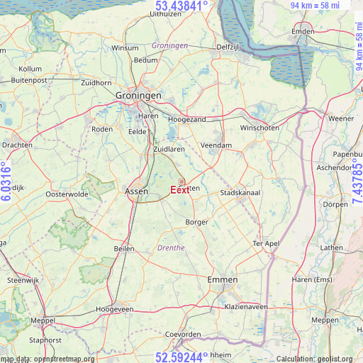
Eext GPS coordinates[2]
53° 1' 3" North, 6° 44' 4.992" East
| Map corner | latitude | longitude |
|---|---|---|
| Upper-left | 53.43841°, | 6.0316° |
| Center: | 53.0175°, | 6.73472° |
| Lower-right: | 52.59244°, | 7.43785° |
| Map W x H: | 94.1×94.1 km | = 58.5×58.5mi |
| max Lat: | 53.48025° ⇑14% North |
| Eext: | 53.0175° |
| min Lat: | ⇓86% South 50.76917° |
| min Long | Eext | max Long |
| 3.38611° | 6.73472° | 7.16528° |
| W 94.2%⇐ | ⇒5.8% E |
Elevation
Elevation of Eext is 18 m = 59 ft, and this is 3 m = 10 ft above average elevation for this country.
| Max E: |
203 m = 666 ft | 25.1% |
| Eext | 18 m 59 ft | |
| Avg. | 15 m = 49 ft | |
Min E: |
-6 m = -20 ft | 74.9% |
See also: Netherlands elevation on elevation.city.
Geographical zone
Eext is located in North temperate zone (between Tropic of Cancer and the Arctic Circle). Distance of this North polar circle is 1506.2 km =935.9 mi to North.| Distance of | km | miles | from Eext |
|---|---|---|---|
| North Pole | 4112.1 | 2555.1 | to North |
| Arctic Circle | 1506.2 | 935.9 | to North |
| Tropic Cancer | 3289.1 | 2043.8 | to South |
| Equator | 5895 | 3663 | to South |


Nearby cities:
15 places around Eext: (largest is in red/bold)
• Annen
4.6 km =2.9 mi,  347°
347°
• Gasselte
6.5 km =4 mi,  141°
141°
• Gasselternijveen
8.5 km =5.3 mi,  112°
112°
• Gasselternijveenschemond
11.2 km =7 mi,  103°
103°
• Gieten
2.4 km =1.5 mi,  125°
125°
• Gieterveen
7 km =4.3 mi,  80°
80°
• Grolloo
10.1 km =6.3 mi,  204°
204°
• Kiel-Windeweer
11 km =6.8 mi,  15°
15°
• Marsdijk
10 km =6.2 mi,  270°
270°
• Rolde
6.9 km =4.3 mi,  237°
237°
• Schipborg
7.7 km =4.8 mi,  326°
326°
• Tynaarlo
10.3 km =6.4 mi,  310°
310°
• Westlaren
8.8 km =5.5 mi, 327°
• Wildervank
11.1 km =6.9 mi,  50°
50°
• Zuidlaren
9.2 km =5.7 mi,  337°
337°
Sources, notices
• [Note1] Compared only with cities in Netherlands existing in our database
• [Src1] Map data: © OpenStreetMap contributors (CC-BY-SA)
• [Src2] Other city data from geonames.org with taken over terms of usage.
• [Src3] Geographical zone / Annual Mean Temperature by Robert A. Rohde @ Wikipedia
