Hurdal geodata
Hurdal (Akershus) is a seat of a second-order administrative division; located in Norway in Europe/Oslo (GMT+2) time zone. In our database, there are 488 cities with bigger population. Compared to other cities in Norway, 53.5% of cities are located further ↑North; 68.7% of cities are located further ←West and 89.4% of cities have lower elevation than Hurdal. Note1


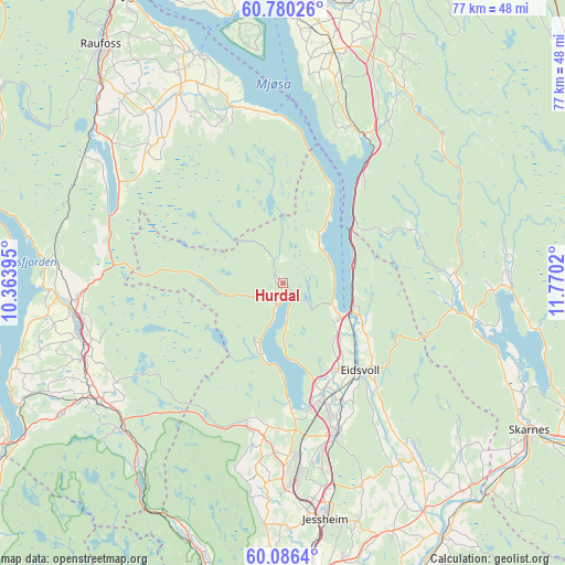
Hurdal GPS coordinates[2]
60° 26' 6.648" North, 11° 4' 1.452" East
| Map corner | latitude | longitude |
|---|---|---|
| Upper-left | 60.78026°, | 10.36395° |
| Center: | 60.43518°, | 11.06707° |
| Lower-right: | 60.0864°, | 11.7702° |
| Map W x H: | 77.1×77.1 km | = 47.9×47.9mi |
| max Lat: | 71.04137° ⇑53.5% North |
| Hurdal: | 60.43518° |
| min Lat: | ⇓46.5% South 58.0274° |
| min Long | Hurdal | max Long |
| 4.71485° | 11.06707° | 31.11066° |
| W 68.7%⇐ | ⇒31.3% E |
Elevation
Elevation of Hurdal is 270 m = 886 ft, and this is 165.8 m = 544 ft above average elevation for this country.
| Max E: |
897 m = 2943 ft | 10.6% |
| Hurdal | 270 m 886 ft | |
| Avg. | 104.2 m = 342 ft | |
Min E: |
1 m = 3 ft | 89.4% |
See also: Norway elevation on elevation.city.
Geographical zone
Hurdal is located in North temperate zone (between Tropic of Cancer and the Arctic Circle). Distance of this North polar circle is 681.4 km =423.4 mi to North.| Distance of | km | miles | from Hurdal |
|---|---|---|---|
| North Pole | 3287.3 | 2042.6 | to North |
| Arctic Circle | 681.4 | 423.4 | to North |
| Tropic Cancer | 4113.8 | 2556.2 | to South |
| Equator | 6719.8 | 4175.5 | to South |


Nearby cities:
15 places around Hurdal: (largest is in red/bold)
• Eidsvoll
15.8 km =9.8 mi,  137°
137°
• Grua
29.8 km =18.5 mi,  228°
228°
• Jaren
28.2 km =17.5 mi,  260°
260°
• Jessheim
33.2 km =20.6 mi,  169°
169°
• Kolbu
29.7 km =18.5 mi,  323°
323°
• Lena
30 km =18.6 mi,  332°
332°
• Maura
19.8 km =12.3 mi,  185°
185°
• Nordkisa
29.8 km =18.5 mi,  158°
158°
• Roa
29.5 km =18.3 mi,  237°
237°
• Råholt
18.8 km =11.7 mi, 160°
• Sand
26.4 km =16.4 mi,  100°
100°
• Sesvoll
21.3 km =13.2 mi, 165°
• Skreia
25.2 km =15.7 mi,  343°
343°
• Stange
32.2 km =20 mi,  12°
12°
• Teigebyen
24 km =14.9 mi, 186°
Sources, notices
• [Note1] Compared only with cities in Norway existing in our database
• [Src1] Map data: © OpenStreetMap contributors (CC-BY-SA)
• [Src2] Other city data from geonames.org with taken over terms of usage.
• [Src3] Geographical zone / Annual Mean Temperature by Robert A. Rohde @ Wikipedia
