Raufoss geodata
Raufoss (Oppland) is a seat of a second-order administrative division; located in Norway in Europe/Oslo (GMT+2) time zone. With population of 6,052 people, there are 74 cities with bigger population in this country. Compared to other cities in Norway, 51.7% of cities are located further ↓South; 60.3% of cities are located further ←West and 92.2% of cities have lower elevation than Raufoss. Note1


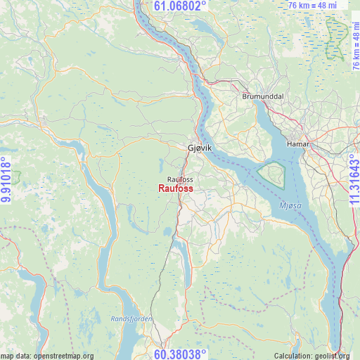
Raufoss GPS coordinates[2]
60° 43' 33.744" North, 10° 36' 47.88" East
| Map corner | latitude | longitude |
|---|---|---|
| Upper-left | 61.06802°, | 9.91018° |
| Center: | 60.72604°, | 10.6133° |
| Lower-right: | 60.38038°, | 11.31643° |
| Map W x H: | 76.5×76.5 km | = 47.5×47.5mi |
| max Lat: | 71.04137° ⇑48.3% North |
| Raufoss: | 60.72604° |
| min Lat: | ⇓51.7% South 58.0274° |
| min Long | Raufoss | max Long |
| 4.71485° | 10.6133° | 31.11066° |
| W 60.3%⇐ | ⇒39.7% E |
Elevation
Elevation of Raufoss is 324 m = 1063 ft, and this is 219.8 m = 721 ft above average elevation for this country.
| Max E: |
897 m = 2943 ft | 7.8% |
| Raufoss | 324 m 1063 ft | |
| Avg. | 104.2 m = 342 ft | |
Min E: |
1 m = 3 ft | 92.2% |
See also: Norway elevation on elevation.city.
Geographical zone
Raufoss is located in North temperate zone (between Tropic of Cancer and the Arctic Circle). Distance of this North polar circle is 649.1 km =403.3 mi to North.| Distance of | km | miles | from Raufoss |
|---|---|---|---|
| North Pole | 3255 | 2022.6 | to North |
| Arctic Circle | 649.1 | 403.3 | to North |
| Tropic Cancer | 4146.2 | 2576.3 | to South |
| Equator | 6752.1 | 4195.6 | to South |


Nearby cities:
15 places around Raufoss: (largest is in red/bold)
• Brumunddal
24.7 km =15.3 mi,  45°
45°
• Dokka
31.7 km =19.7 mi,  292°
292°
• Eina
10.9 km =6.8 mi,  184°
184°
• Gjøvik
8.8 km =5.5 mi,  28°
28°
• Hamar
25.8 km =16 mi,  72°
72°
• Hov
14.5 km =9 mi,  257°
257°
• Ilseng
33.8 km =21 mi,  80°
80°
• Jaren
37.2 km =23.1 mi, 184°
• Kolbu
11.1 km =6.9 mi,  139°
139°
• Lena
12.3 km =7.6 mi,  118°
118°
• Moelv
23.5 km =14.6 mi,  11°
11°
• Reinsvoll
5.2 km =3.2 mi,  174°
174°
• Skreia
19.4 km =12.1 mi,  114°
114°
• Stange
31.6 km =19.6 mi,  91°
91°
• Ådalsbruk
38.6 km =24 mi, 78°
Sources, notices
• [Note1] Compared only with cities in Norway existing in our database
• [Src1] Map data: © OpenStreetMap contributors (CC-BY-SA)
• [Src2] Other city data from geonames.org with taken over terms of usage.
• [Src3] Geographical zone / Annual Mean Temperature by Robert A. Rohde @ Wikipedia
