Kyrkjebygda geodata
Kyrkjebygda (Vest-Agder) is a seat of a second-order administrative division; located in Norway in Europe/Oslo (GMT+2) time zone. In our database, there are 488 cities with bigger population. Compared to other cities in Norway, 94.1% of cities are located further ↑North; 70.7% of cities are located further →East and 88.9% of cities have lower elevation than Kyrkjebygda. Note1


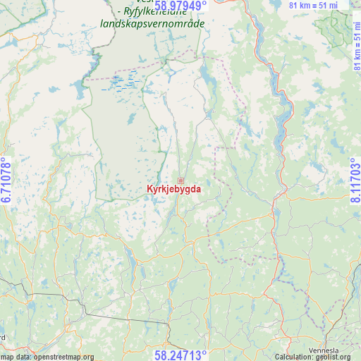
Kyrkjebygda GPS coordinates[2]
58° 36' 54.828" North, 7° 24' 50.076" East
| Map corner | latitude | longitude |
|---|---|---|
| Upper-left | 58.97949°, | 6.71078° |
| Center: | 58.61523°, | 7.41391° |
| Lower-right: | 58.24713°, | 8.11703° |
| Map W x H: | 81.4×81.4 km | = 50.6×50.6mi |
| max Lat: | 71.04137° ⇑94.1% North |
| Kyrkjebygda: | 58.61523° |
| min Lat: | ⇓5.9% South 58.0274° |
| min Long | Kyrkjebygda | max Long |
| 4.71485° | 7.41391° | 31.11066° |
| W 29.3%⇐ | ⇒70.7% E |
Elevation
Elevation of Kyrkjebygda is 262 m = 860 ft, and this is 157.8 m = 518 ft above average elevation for this country.
| Max E: |
897 m = 2943 ft | 11.1% |
| Kyrkjebygda | 262 m 860 ft | |
| Avg. | 104.2 m = 342 ft | |
Min E: |
1 m = 3 ft | 88.9% |
See also: Norway elevation on elevation.city.
Geographical zone
Kyrkjebygda is located in North temperate zone (between Tropic of Cancer and the Arctic Circle). Distance of this North polar circle is 883.8 km =549.2 mi to North.| Distance of | km | miles | from Kyrkjebygda |
|---|---|---|---|
| North Pole | 3489.7 | 2168.4 | to North |
| Arctic Circle | 883.8 | 549.2 | to North |
| Tropic Cancer | 3911.5 | 2430.5 | to South |
| Equator | 6517.4 | 4049.7 | to South |


Nearby cities:
15 places around Kyrkjebygda: (largest is in red/bold)
• Birketveit
34 km =21.1 mi,  120°
120°
• Bygland
32.4 km =20.1 mi,  42°
42°
• Evje
22.8 km =14.2 mi,  98°
98°
• Flekkefjord
56.3 km =35 mi,  231°
231°
• Helland
47.3 km =29.4 mi,  172°
172°
• Konsmo
36.8 km =22.9 mi,  185°
185°
• Liknes
42.7 km =26.5 mi,  217°
217°
• Lyngdal
56.8 km =35.3 mi,  200°
200°
• Moi
53 km =32.9 mi,  250°
250°
• Nodeland
56.8 km =35.3 mi,  154°
154°
• Sira
48.7 km =30.3 mi,  243°
243°
• Strai
56 km =34.8 mi, 147°
• Tingvatn
28.9 km =18 mi, 202°
• Tonstad
40.7 km =25.3 mi,  277°
277°
• Vennesla
50.4 km =31.3 mi,  139°
139°
Sources, notices
• [Note1] Compared only with cities in Norway existing in our database
• [Src1] Map data: © OpenStreetMap contributors (CC-BY-SA)
• [Src2] Other city data from geonames.org with taken over terms of usage.
• [Src3] Geographical zone / Annual Mean Temperature by Robert A. Rohde @ Wikipedia
