Ramberg geodata
Ramberg (Nordland) is a seat of a second-order administrative division; located in Norway in Europe/Oslo (GMT+2) time zone. In our database, there are 488 cities with bigger population. Compared to other cities in Norway, 88.9% of cities are located further ↓South; 85.3% of cities are located further ←West and 69.5% of cities have lower elevation than Ramberg. Note1


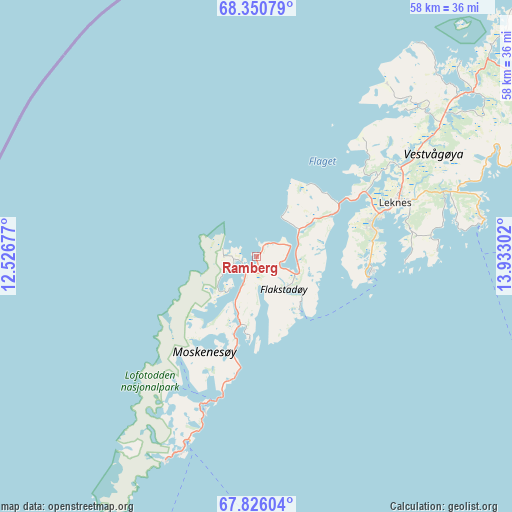
Ramberg GPS coordinates[2]
68° 5' 23.676" North, 13° 13' 47.604" East
| Map corner | latitude | longitude |
|---|---|---|
| Upper-left | 68.35079°, | 12.52677° |
| Center: | 68.08991°, | 13.22989° |
| Lower-right: | 67.82604°, | 13.93302° |
| Map W x H: | 58.3×58.3 km | = 36.2×36.2mi |
| max Lat: | 71.04137° ⇑11.1% North |
| Ramberg: | 68.08991° |
| min Lat: | ⇓88.9% South 58.0274° |
| min Long | Ramberg | max Long |
| 4.71485° | 13.22989° | 31.11066° |
| W 85.3%⇐ | ⇒14.7% E |
Elevation
Elevation of Ramberg is 120 m = 394 ft, and this is 15.8 m = 52 ft above average elevation for this country.
| Max E: |
897 m = 2943 ft | 30.5% |
| Ramberg | 120 m 394 ft | |
| Avg. | 104.2 m = 342 ft | |
Min E: |
1 m = 3 ft | 69.5% |
See also: Norway elevation on elevation.city.
Geographical zone
Ramberg is located in North Frigid zone (between North Pole and Arctic Circle). Distance of this North polar circle is 169.7 km =105.4 mi to South.| Distance of | km | miles | from Ramberg |
|---|---|---|---|
| North Pole | 2436.2 | 1513.8 | to North |
| Arctic Circle | 169.7 | 105.4 | to South |
| Tropic Cancer | 4965 | 3085.1 | to South |
| Equator | 7570.9 | 4704.3 | to South |


Nearby cities:
15 places around Ramberg: (largest is in red/bold)
• Ballstad
13.2 km =8.2 mi,  97°
97°
• Evjen
28.6 km =17.8 mi,  46°
46°
• Gravdal
13.8 km =8.6 mi,  76°
76°
• Kabelvåg
53.3 km =33.1 mi, 75°
• Leinesfjorden
82.4 km =51.2 mi,  115°
115°
• Leknes
17.1 km =10.6 mi,  67°
67°
• Melbu
79.2 km =49.2 mi, 54°
• Oppeid
98.7 km =61.3 mi,  90°
90°
• Reine
18.5 km =11.5 mi,  198°
198°
• Røst
78.9 km =49 mi,  216°
216°
• Stamsund
26.1 km =16.2 mi, 80°
• Stokmarknes
86.9 km =54 mi, 52°
• Straume
83.8 km =52.1 mi,  37°
37°
• Svolvær
57.6 km =35.8 mi, 73°
• Sørland
52.2 km =32.4 mi,  205°
205°
Sources, notices
• [Note1] Compared only with cities in Norway existing in our database
• [Src1] Map data: © OpenStreetMap contributors (CC-BY-SA)
• [Src2] Other city data from geonames.org with taken over terms of usage.
• [Src3] Geographical zone / Annual Mean Temperature by Robert A. Rohde @ Wikipedia
