Skei geodata
Skei (Sogn og Fjordane) is a seat of a second-order administrative division; located in Norway in Europe/Oslo (GMT+2) time zone. In our database, there are 488 cities with bigger population. Compared to other cities in Norway, 60.8% of cities are located further ↓South; 78.6% of cities are located further →East and 88.1% of cities have lower elevation than Skei. Note1


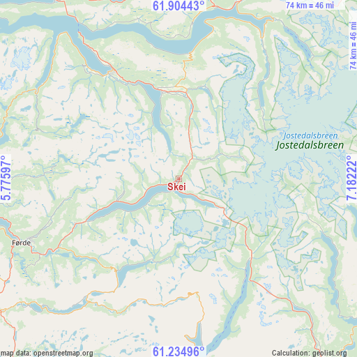
Skei GPS coordinates[2]
61° 34' 17.4" North, 6° 28' 44.76" East
| Map corner | latitude | longitude |
|---|---|---|
| Upper-left | 61.90443°, | 5.77597° |
| Center: | 61.5715°, | 6.4791° |
| Lower-right: | 61.23496°, | 7.18222° |
| Map W x H: | 74.4×74.4 km | = 46.2×46.2mi |
| max Lat: | 71.04137° ⇑39.2% North |
| Skei: | 61.5715° |
| min Lat: | ⇓60.8% South 58.0274° |
| min Long | Skei | max Long |
| 4.71485° | 6.4791° | 31.11066° |
| W 21.4%⇐ | ⇒78.6% E |
Elevation
Elevation of Skei is 240 m = 787 ft, and this is 135.8 m = 446 ft above average elevation for this country.
| Max E: |
897 m = 2943 ft | 11.9% |
| Skei | 240 m 787 ft | |
| Avg. | 104.2 m = 342 ft | |
Min E: |
1 m = 3 ft | 88.1% |
See also: Norway elevation on elevation.city.
Geographical zone
Skei is located in North temperate zone (between Tropic of Cancer and the Arctic Circle). Distance of this North polar circle is 555.1 km =344.9 mi to North.| Distance of | km | miles | from Skei |
|---|---|---|---|
| North Pole | 3161 | 1964.2 | to North |
| Arctic Circle | 555.1 | 344.9 | to North |
| Tropic Cancer | 4240.2 | 2634.7 | to South |
| Equator | 6846.1 | 4254 | to South |


Nearby cities:
15 places around Skei: (largest is in red/bold)
• Balestrand
40.4 km =25.1 mi,  175°
175°
• Førde
35.6 km =22.1 mi,  248°
248°
• Gaupne
47.1 km =29.3 mi,  113°
113°
• Hermansverk
47.3 km =29.4 mi,  155°
155°
• Hornindal
44.3 km =27.5 mi,  3°
3°
• Høyanger
44 km =27.3 mi,  208°
208°
• Naustdal
40.9 km =25.4 mi,  260°
260°
• Nordfjordeid
45.9 km =28.5 mi,  325°
325°
• Sandane
26.4 km =16.4 mi, 328°
• Sande
45.4 km =28.2 mi,  232°
232°
• Sogndal
50.3 km =31.3 mi,  139°
139°
• Sogndalsfjøra
50.8 km =31.6 mi, 139°
• Stryn
38.9 km =24.2 mi,  18°
18°
• Vik
57.4 km =35.7 mi,  174°
174°
• Vikøyri
54.1 km =33.6 mi, 174°
Sources, notices
• [Note1] Compared only with cities in Norway existing in our database
• [Src1] Map data: © OpenStreetMap contributors (CC-BY-SA)
• [Src2] Other city data from geonames.org with taken over terms of usage.
• [Src3] Geographical zone / Annual Mean Temperature by Robert A. Rohde @ Wikipedia
