Mo i Rana geodata
Mo i Rana (Nordland) is a seat of a second-order administrative division; located in Norway in Europe/Oslo (GMT+2) time zone. With population of 17,853 people, there are 28 cities with bigger population in this country. Compared to other cities in Norway, 85.6% of cities are located further ↓South; 88% of cities are located further ←West and 52.7% of cities have higher elevation than Mo i Rana. Note1


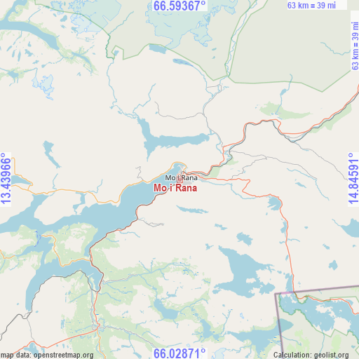
Mo i Rana GPS coordinates[2]
66° 18' 46.008" North, 14° 8' 34.008" East
| Map corner | latitude | longitude |
|---|---|---|
| Upper-left | 66.59367°, | 13.43966° |
| Center: | 66.31278°, | 14.14278° |
| Lower-right: | 66.02871°, | 14.84591° |
| Map W x H: | 62.8×62.8 km | = 39×39mi |
| max Lat: | 71.04137° ⇑14.4% North |
| Mo i Rana: | 66.31278° |
| min Lat: | ⇓85.6% South 58.0274° |
| min Long | Mo i Rana | max Long |
| 4.71485° | 14.14278° | 31.11066° |
| W 88%⇐ | ⇒12% E |
Elevation
Elevation of Mo i Rana is 40 m = 131 ft, and this is 64.2 m = 211 ft below average elevation for this country.
| Max E: |
897 m = 2943 ft | 52.7% |
| Avg. | 104.2 m = 342 ft | |
| Mo i Rana | 40 m = 131 ft | |
Min E: |
1 m = 3 ft | 47.3% |
See also: Norway elevation on elevation.city.
Geographical zone
Mo i Rana is located in North temperate zone (between Tropic of Cancer and the Arctic Circle). Distance of this North polar circle is 27.9 km =17.3 mi to North.| Distance of | km | miles | from Mo i Rana |
|---|---|---|---|
| North Pole | 2633.8 | 1636.6 | to North |
| Arctic Circle | 27.9 | 17.3 | to North |
| Tropic Cancer | 4767.4 | 2962.3 | to South |
| Equator | 7373.3 | 4581.6 | to South |


Nearby cities:
15 places around Mo i Rana: (largest is in red/bold)
• Glomfjord
56.7 km =35.2 mi,  351°
351°
• Hattfjelldal
79.9 km =49.6 mi,  185°
185°
• Hauknes
4.7 km =2.9 mi,  226°
226°
• Hemnesberget
25.5 km =15.8 mi,  247°
247°
• Korgen
30 km =18.6 mi,  208°
208°
• Leland
60.5 km =37.6 mi,  242°
242°
• Lurøy
59.1 km =36.7 mi,  281°
281°
• Moldjord
79.4 km =49.3 mi,  13°
13°
• Mosjøen
68.2 km =42.4 mi,  218°
218°
• Nesna
51.9 km =32.2 mi,  255°
255°
• Sandnessjøen
75.2 km =46.7 mi, 244°
• Solfjellsjøen
77.5 km =48.2 mi, 253°
• Storforshei
20 km =12.4 mi,  59°
59°
• Vågaholmen
58.5 km =36.4 mi,  319°
319°
• Ørnes
64.8 km =40.3 mi,  342°
342°
Sources, notices
• [Note1] Compared only with cities in Norway existing in our database
• [Src1] Map data: © OpenStreetMap contributors (CC-BY-SA)
• [Src2] Other city data from geonames.org with taken over terms of usage.
• [Src3] Geographical zone / Annual Mean Temperature by Robert A. Rohde @ Wikipedia
