Storforshei geodata
Storforshei (Nordland) is a populated place; located in Norway in Europe/Oslo (GMT+2) time zone. With population of 690 people, there are 386 cities with bigger population in this country. Compared to other cities in Norway, 85.8% of cities are located further ↓South; 88.8% of cities are located further ←West and 66% of cities have lower elevation than Storforshei. Note1


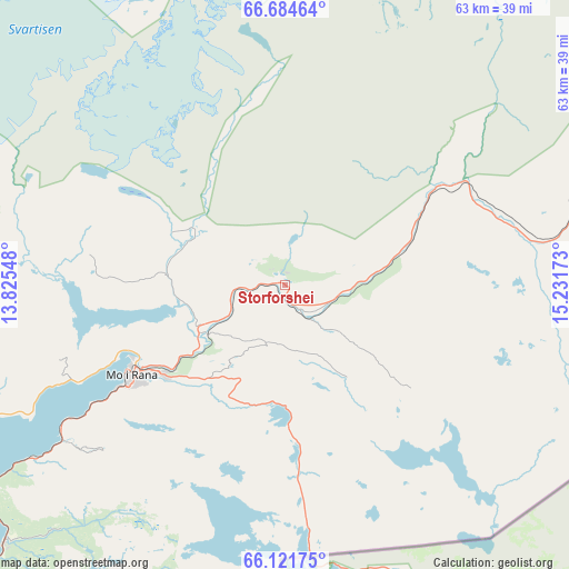
Storforshei GPS coordinates[2]
66° 24' 17.208" North, 14° 31' 42.96" East
| Map corner | latitude | longitude |
|---|---|---|
| Upper-left | 66.68464°, | 13.82548° |
| Center: | 66.40478°, | 14.5286° |
| Lower-right: | 66.12175°, | 15.23173° |
| Map W x H: | 62.6×62.6 km | = 38.9×38.9mi |
| max Lat: | 71.04137° ⇑14.2% North |
| Storforshei: | 66.40478° |
| min Lat: | ⇓85.8% South 58.0274° |
| min Long | Storforshei | max Long |
| 4.71485° | 14.5286° | 31.11066° |
| W 88.8%⇐ | ⇒11.2% E |
Elevation
Elevation of Storforshei is 100 m = 328 ft, and this is 4.2 m = 14 ft below average elevation for this country.
| Max E: |
897 m = 2943 ft | 34% |
| Avg. | 104.2 m = 342 ft | |
| Storforshei | 100 m = 328 ft | |
Min E: |
1 m = 3 ft | 66% |
See also: Norway elevation on elevation.city.
Geographical zone
Storforshei is located in North temperate zone (between Tropic of Cancer and the Arctic Circle). Distance of this North polar circle is 17.7 km =11 mi to North.| Distance of | km | miles | from Storforshei |
|---|---|---|---|
| North Pole | 2623.5 | 1630.2 | to North |
| Arctic Circle | 17.7 | 11 | to North |
| Tropic Cancer | 4777.6 | 2968.7 | to South |
| Equator | 7383.5 | 4587.9 | to South |


Nearby cities:
15 places around Storforshei: (largest is in red/bold)
• Glomfjord
52.6 km =32.7 mi,  330°
330°
• Hattfjelldal
93 km =57.8 mi,  195°
195°
• Hauknes
24.6 km =15.3 mi,  236°
236°
• Hemnesberget
45.4 km =28.2 mi, 243°
• Inndyr
73.3 km =45.5 mi,  342°
342°
• Korgen
48.3 km =30 mi,  220°
220°
• Leland
80.5 km =50 mi, 241°
• Lurøy
75 km =46.6 mi,  271°
271°
• Mo i Rana
20 km =12.4 mi, 239°
• Moldjord
66.9 km =41.6 mi,  1°
1°
• Mosjøen
87.3 km =54.2 mi, 223°
• Nesna
71.3 km =44.3 mi,  251°
251°
• Rognan
86.1 km =53.5 mi,  26°
26°
• Vågaholmen
64.8 km =40.3 mi,  302°
302°
• Ørnes
63.1 km =39.2 mi,  324°
324°
Sources, notices
• [Note1] Compared only with cities in Norway existing in our database
• [Src1] Map data: © OpenStreetMap contributors (CC-BY-SA)
• [Src2] Other city data from geonames.org with taken over terms of usage.
• [Src3] Geographical zone / Annual Mean Temperature by Robert A. Rohde @ Wikipedia
