Leirsund geodata
Leirsund (Akershus) is a populated place; located in Norway in Europe/Oslo (GMT+2) time zone. With population of 1,177 people, there are 273 cities with bigger population in this country. Compared to other cities in Norway, 64.7% of cities are located further ↑North; 69.3% of cities are located further ←West and 68% of cities have lower elevation than Leirsund. Note1


Leirsund GPS coordinates[2]
59° 59' 48.552" North, 11° 5' 14.856" East
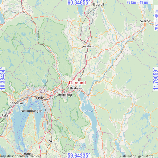
| Map corner | latitude | longitude |
|---|---|---|
| Upper-left | 60.34655°, | 10.38434° |
| Center: | 59.99682°, | 11.08746° |
| Lower-right: | 59.64335°, | 11.79059° |
| Map W x H: | 78.2×78.2 km | = 48.6×48.6mi |
| max Lat: | 71.04137° ⇑64.7% North |
| Leirsund: | 59.99682° |
| min Lat: | ⇓35.3% South 58.0274° |
| min Long | Leirsund | max Long |
| 4.71485° | 11.08746° | 31.11066° |
| W 69.3%⇐ | ⇒30.7% E |
Elevation
Elevation of Leirsund is 113 m = 371 ft, and this is 8.8 m = 29 ft above average elevation for this country.
| Max E: |
897 m = 2943 ft | 32% |
| Leirsund | 113 m 371 ft | |
| Avg. | 104.2 m = 342 ft | |
Min E: |
1 m = 3 ft | 68% |
See also: Norway elevation on elevation.city.
Geographical zone
Leirsund is located in North temperate zone (between Tropic of Cancer and the Arctic Circle). Distance of this North polar circle is 730.2 km =453.7 mi to North.| Distance of | km | miles | from Leirsund |
|---|---|---|---|
| North Pole | 3336 | 2072.9 | to North |
| Arctic Circle | 730.2 | 453.7 | to North |
| Tropic Cancer | 4065.1 | 2525.9 | to South |
| Equator | 6671 | 4145.2 | to South |


Nearby cities:
15 places around Leirsund: (largest is in red/bold)
• Ask
8.8 km =5.5 mi,  341°
341°
• Auli
15.7 km =9.8 mi,  74°
74°
• Børgen
12.9 km =8 mi,  32°
32°
• Fetsund
8.9 km =5.5 mi,  154°
154°
• Fjerdingby
7.9 km =4.9 mi,  188°
188°
• Frogner
3.2 km =2 mi,  15°
15°
• Jessheim
16.8 km =10.4 mi, 16°
• Kjenn
10.4 km =6.5 mi,  225°
225°
• Kløfta
9 km =5.6 mi, 18°
• Lillestrøm
5 km =3.1 mi,  205°
205°
• Lindeberg
5 km =3.1 mi, 23°
• Lørenfallet
8.3 km =5.2 mi, 72°
• Rotnes
14.2 km =8.8 mi,  298°
298°
• Sørumsand
8.6 km =5.3 mi,  97°
97°
• Åneby
15.9 km =9.9 mi,  310°
310°
Sources, notices
• [Note1] Compared only with cities in Norway existing in our database
• [Src1] Map data: © OpenStreetMap contributors (CC-BY-SA)
• [Src2] Other city data from geonames.org with taken over terms of usage.
• [Src3] Geographical zone / Annual Mean Temperature by Robert A. Rohde @ Wikipedia
