Hvittingfoss geodata
Hvittingfoss (Buskerud) is a populated place; located in Norway in Europe/Oslo (GMT+2) time zone. With population of 1,016 people, there are 309 cities with bigger population in this country. Compared to other cities in Norway, 78.8% of cities are located further ↑North; 51.4% of cities are located further →East and 61.6% of cities have lower elevation than Hvittingfoss. Note1


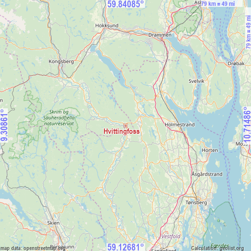
Hvittingfoss GPS coordinates[2]
59° 29' 8.592" North, 10° 0' 42.228" East
| Map corner | latitude | longitude |
|---|---|---|
| Upper-left | 59.84085°, | 9.30861° |
| Center: | 59.48572°, | 10.01173° |
| Lower-right: | 59.12681°, | 10.71486° |
| Map W x H: | 79.4×79.4 km | = 49.3×49.3mi |
| max Lat: | 71.04137° ⇑78.8% North |
| Hvittingfoss: | 59.48572° |
| min Lat: | ⇓21.2% South 58.0274° |
| min Long | Hvittingfoss | max Long |
| 4.71485° | 10.01173° | 31.11066° |
| W 48.6%⇐ | ⇒51.4% E |
Elevation
Elevation of Hvittingfoss is 73 m = 240 ft, and this is 31.2 m = 102 ft below average elevation for this country.
| Max E: |
897 m = 2943 ft | 38.4% |
| Avg. | 104.2 m = 342 ft | |
| Hvittingfoss | 73 m = 240 ft | |
Min E: |
1 m = 3 ft | 61.6% |
See also: Norway elevation on elevation.city.
Geographical zone
Hvittingfoss is located in North temperate zone (between Tropic of Cancer and the Arctic Circle). Distance of this North polar circle is 787 km =489 mi to North.| Distance of | km | miles | from Hvittingfoss |
|---|---|---|---|
| North Pole | 3392.9 | 2108.2 | to North |
| Arctic Circle | 787 | 489 | to North |
| Tropic Cancer | 4008.3 | 2490.6 | to South |
| Equator | 6614.2 | 4109.9 | to South |


Nearby cities:
15 places around Hvittingfoss: (largest is in red/bold)
• Andebu
22.1 km =13.7 mi,  154°
154°
• Barkåker
28.3 km =17.6 mi,  130°
130°
• Berger
22.3 km =13.9 mi,  71°
71°
• Gullhaug
13.7 km =8.5 mi,  82°
82°
• Holmestrand
17.3 km =10.7 mi,  89°
89°
• Horten
27.7 km =17.2 mi,  105°
105°
• Kongsberg
28.8 km =17.9 mi,  314°
314°
• Nykirke
22.2 km =13.8 mi, 108°
• Revetal
19 km =11.8 mi, 131°
• Sande
15.8 km =9.8 mi,  44°
44°
• Selvik
16.6 km =10.3 mi,  57°
57°
• Siljan
27.8 km =17.3 mi,  217°
217°
• Skoger
28.7 km =17.8 mi,  28°
28°
• Skoppum
25.1 km =15.6 mi,  116°
116°
• Svelvik
26.5 km =16.5 mi, 57°
Sources, notices
• [Note1] Compared only with cities in Norway existing in our database
• [Src1] Map data: © OpenStreetMap contributors (CC-BY-SA)
• [Src2] Other city data from geonames.org with taken over terms of usage.
• [Src3] Geographical zone / Annual Mean Temperature by Robert A. Rohde @ Wikipedia
