Rømskog geodata
Rømskog (Østfold) is a seat of a second-order administrative division; located in Norway in Europe/Oslo (GMT+2) time zone. In our database, there are 488 cities with bigger population. Compared to other cities in Norway, 71.8% of cities are located further ↑North; 80.1% of cities are located further ←West and 80.2% of cities have lower elevation than Rømskog. Note1


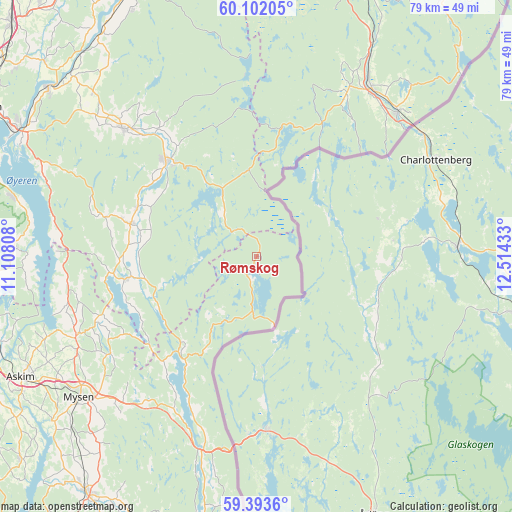
Rømskog GPS coordinates[2]
59° 44' 58.92" North, 11° 48' 40.32" East
| Map corner | latitude | longitude |
|---|---|---|
| Upper-left | 60.10205°, | 11.10808° |
| Center: | 59.7497°, | 11.8112° |
| Lower-right: | 59.3936°, | 12.51433° |
| Map W x H: | 78.8×78.8 km | = 49×49mi |
| max Lat: | 71.04137° ⇑71.8% North |
| Rømskog: | 59.7497° |
| min Lat: | ⇓28.2% South 58.0274° |
| min Long | Rømskog | max Long |
| 4.71485° | 11.8112° | 31.11066° |
| W 80.1%⇐ | ⇒19.9% E |
Elevation
Elevation of Rømskog is 171 m = 561 ft, and this is 66.8 m = 219 ft above average elevation for this country.
| Max E: |
897 m = 2943 ft | 19.8% |
| Rømskog | 171 m 561 ft | |
| Avg. | 104.2 m = 342 ft | |
Min E: |
1 m = 3 ft | 80.2% |
See also: Norway elevation on elevation.city.
Geographical zone
Rømskog is located in North temperate zone (between Tropic of Cancer and the Arctic Circle). Distance of this North polar circle is 757.6 km =470.8 mi to North.| Distance of | km | miles | from Rømskog |
|---|---|---|---|
| North Pole | 3363.5 | 2090 | to North |
| Arctic Circle | 757.6 | 470.8 | to North |
| Tropic Cancer | 4037.6 | 2508.8 | to South |
| Equator | 6643.5 | 4128.1 | to South |


Nearby cities:
15 places around Rømskog: (largest is in red/bold)
• Askim
40.8 km =25.4 mi,  243°
243°
• Auli
40.4 km =25.1 mi,  321°
321°
• Aursmoen
28.5 km =17.7 mi,  313°
313°
• Bjørkelangen
20.3 km =12.6 mi, 317°
• Flateby
37.9 km =23.5 mi,  283°
283°
• Fosser
19.8 km =12.3 mi,  293°
293°
• Heiås
29.3 km =18.2 mi,  259°
259°
• Hemnes
20.2 km =12.6 mi, 260°
• Kirkebygda
37.3 km =23.2 mi,  272°
272°
• Løken
20 km =12.4 mi, 284°
• Magnor
31.2 km =19.4 mi,  44°
44°
• Mysen
34.9 km =21.7 mi,  231°
231°
• Skjønhaug
30.3 km =18.8 mi,  246°
246°
• Skotterud
31.4 km =19.5 mi,  34°
34°
• Ørje
31.1 km =19.3 mi,  195°
195°
Sources, notices
• [Note1] Compared only with cities in Norway existing in our database
• [Src1] Map data: © OpenStreetMap contributors (CC-BY-SA)
• [Src2] Other city data from geonames.org with taken over terms of usage.
• [Src3] Geographical zone / Annual Mean Temperature by Robert A. Rohde @ Wikipedia
