Pisang geodata
Pisang (Western Region) is a seat of a fourth-order administrative division; located in Nepal in Asia/Kathmandu (GMT+5.75) time zone. In our database, there are 62 cities with bigger population. Compared to other cities in Nepal, 82.4% of cities are located further ↓South; 54.1% of cities are located further →East and 94.6% of cities have lower elevation than Pisang. Note1
Administrative division(s):
- Level 1: Western Region
- Level 2: Gandakī Zone
- Level 3: Manang
- Level 4: Pisang


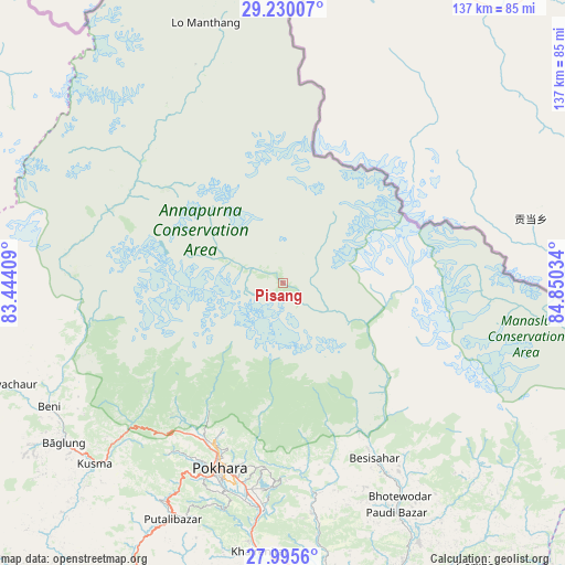
Pisang GPS coordinates[2]
28° 36' 52.74" North, 84° 8' 49.956" East
| Map corner | latitude | longitude |
|---|---|---|
| Upper-left | 29.23007°, | 83.44409° |
| Center: | 28.61465°, | 84.14721° |
| Lower-right: | 27.9956°, | 84.85034° |
| Map W x H: | 137.3×137.3 km | = 85.3×85.3mi |
| max Lat: | 30.04651° ⇑17.6% North |
| Pisang: | 28.61465° |
| min Lat: | ⇓82.4% South 26.45505° |
| min Long | Pisang | max Long |
| 80.17715° | 84.14721° | 88.09436° |
| W 45.9%⇐ | ⇒54.1% E |
Elevation
Elevation of Pisang is 3205 m = 10515 ft, and this is 2029.8 m = 6659 ft above average elevation for this country.
| Max E: |
5251 m = 17228 ft | 5.4% |
| Pisang | 3205 m 10515 ft | |
| Avg. | 1175.2 m = 3856 ft | |
Min E: |
72 m = 236 ft | 94.6% |
See also: Nepal elevation on elevation.city.
Geographical zone
Pisang is located in North temperate zone (between Tropic of Cancer and the Arctic Circle). Distance of this Northern Tropic circle is 575.7 km =357.7 mi to South.| Distance of | km | miles | from Pisang |
|---|---|---|---|
| North Pole | 6825.4 | 4241.1 | to North |
| Arctic Circle | 4219.5 | 2621.9 | to North |
| Tropic Cancer | 575.7 | 357.7 | to South |
| Equator | 3181.7 | 1977 | to South |


Nearby cities:
15 places around Pisang: (largest is in red/bold)
• Bharatpur
108.1 km =67.2 mi,  164°
164°
• Bhattarai Danda
84 km =52.2 mi,  194°
194°
• Butwāl
122.6 km =76.2 mi,  213°
213°
• Bāglung
66.5 km =41.3 mi,  235°
235°
• Chame
12.2 km =7.6 mi,  123°
123°
• Chitre
49.2 km =30.6 mi, 244°
• Dihi
85 km =52.8 mi, 194°
• Jomsom
44.4 km =27.6 mi,  295°
295°
• Khudi
42.4 km =26.3 mi,  150°
150°
• Lamjung
49.7 km =30.9 mi, 154°
• Nawal
5.7 km =3.5 mi,  310°
310°
• Pokhara
42.4 km =26.3 mi,  204°
204°
• Sundar Basti
84 km =52.2 mi, 194°
• Tānsen
101.8 km =63.3 mi,  215°
215°
• Wāliṅ
79.8 km =49.6 mi, 208°
Sources, notices
• [Note1] Compared only with cities in Nepal existing in our database
• [Src1] Map data: © OpenStreetMap contributors (CC-BY-SA)
• [Src2] Other city data from geonames.org with taken over terms of usage.
• [Src3] Geographical zone / Annual Mean Temperature by Robert A. Rohde @ Wikipedia
