Siddharthanagar geodata
Siddharthanagar (Western Region) is a seat of a third-order administrative division; located in Nepal in Asia/Kathmandu (GMT+5.75) time zone. With population of 63,367 people, there are 16 cities with bigger population in this country. Compared to other cities in Nepal, 73% of cities are located further ↑North; 68.9% of cities are located further →East and 86.5% of cities have higher elevation than Siddharthanagar. Note1
Administrative division(s):
- Level 1: Western Region
- Level 2: Lumbinī Zone
- Level 3: Rūpandehī
- Level 4: SiddharthNagarN.P.


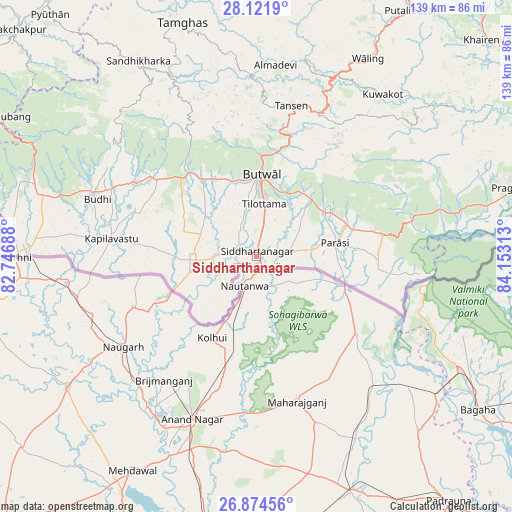
Siddharthanagar GPS coordinates[2]
27° 30' 0" North, 83° 27' 0" East
| Map corner | latitude | longitude |
|---|---|---|
| Upper-left | 28.1219°, | 82.74688° |
| Center: | 27.5°, | 83.45° |
| Lower-right: | 26.87456°, | 84.15313° |
| Map W x H: | 138.7×138.7 km | = 86.2×86.2mi |
| max Lat: | 30.04651° ⇑73% North |
| Siddharthanagar: | 27.5° |
| min Lat: | ⇓27% South 26.45505° |
| min Long | Siddharthanagar | max Long |
| 80.17715° | 83.45° | 88.09436° |
| W 31.1%⇐ | ⇒68.9% E |
Elevation
Elevation of Siddharthanagar is 107 m = 351 ft, and this is 1068.2 m = 3505 ft below average elevation for this country.
| Max E: |
5251 m = 17228 ft | 86.5% |
| Avg. | 1175.2 m = 3856 ft | |
| Siddharthanagar | 107 m = 351 ft | |
Min E: |
72 m = 236 ft | 13.5% |
See also: Siddharthanagar elevation on elevation.city.
Geographical zone
Siddharthanagar is located in North temperate zone (between Tropic of Cancer and the Arctic Circle). Distance of this Northern Tropic circle is 451.8 km =280.7 mi to South.| Distance of | km | miles | from Siddharthanagar |
|---|---|---|---|
| North Pole | 6949.3 | 4318.1 | to North |
| Arctic Circle | 4343.5 | 2698.9 | to North |
| Tropic Cancer | 451.8 | 280.7 | to South |
| Equator | 3057.7 | 1900 | to South |


Nearby cities:
15 places around Siddharthanagar: (largest is in red/bold)
• Besisahar
130.6 km =81.2 mi,  308°
308°
• Bharatpur
99.1 km =61.6 mi,  78°
78°
• Bhattarai Danda
63.9 km =39.7 mi,  48°
48°
• Butwāl
22.3 km =13.9 mi,  359°
359°
• Bāglung
86.9 km =54 mi,  9°
9°
• Chitre
105.7 km =65.7 mi, 12°
• Dihi
62.9 km =39.1 mi, 48°
• Khudi
124.7 km =77.5 mi, 45°
• Lamjung
119.6 km =74.3 mi, 48°
• Pokhara
99.3 km =61.7 mi,  30°
30°
• Pyūthān
85.9 km =53.4 mi,  319°
319°
• Sundar Basti
63.8 km =39.6 mi, 48°
• Tulsīpur
133.3 km =82.8 mi,  301°
301°
• Tānsen
41.9 km =26 mi, 13°
• Wāliṅ
61.8 km =38.4 mi, 29°
Sources, notices
• [Note1] Compared only with cities in Nepal existing in our database
• [Src1] Map data: © OpenStreetMap contributors (CC-BY-SA)
• [Src2] Other city data from geonames.org with taken over terms of usage.
• [Src3] Geographical zone / Annual Mean Temperature by Robert A. Rohde @ Wikipedia
