Khanbari geodata
Khanbari (Eastern Region) is a populated place; located in Nepal in Asia/Kathmandu (GMT+5.75) time zone. With population of 22,903 people, there are 33 cities with bigger population in this country. Compared to other cities in Nepal, 75.7% of cities are located further ↑North; 91.9% of cities are located further ←West and 54.1% of cities have higher elevation than Khanbari. Note1


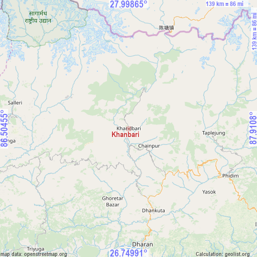
Khanbari GPS coordinates[2]
27° 22' 33.744" North, 87° 12' 27.612" East
| Map corner | latitude | longitude |
|---|---|---|
| Upper-left | 27.99865°, | 86.50455° |
| Center: | 27.37604°, | 87.20767° |
| Lower-right: | 26.74991°, | 87.9108° |
| Map W x H: | 138.8×138.8 km | = 86.2×86.2mi |
| max Lat: | 30.04651° ⇑75.7% North |
| Khanbari: | 27.37604° |
| min Lat: | ⇓24.3% South 26.45505° |
| min Long | Khanbari | max Long |
| 80.17715° | 87.20767° | 88.09436° |
| W 91.9%⇐ | ⇒8.1% E |
Elevation
Elevation of Khanbari is 892 m = 2927 ft, and this is 283.2 m = 929 ft below average elevation for this country.
| Max E: |
5251 m = 17228 ft | 54.1% |
| Avg. | 1175.2 m = 3856 ft | |
| Khanbari | 892 m = 2927 ft | |
Min E: |
72 m = 236 ft | 45.9% |
See also: Nepal elevation on elevation.city.
Geographical zone
Khanbari is located in North temperate zone (between Tropic of Cancer and the Arctic Circle). Distance of this Northern Tropic circle is 438 km =272.2 mi to South.| Distance of | km | miles | from Khanbari |
|---|---|---|---|
| North Pole | 6963.1 | 4326.7 | to North |
| Arctic Circle | 4357.2 | 2707.4 | to North |
| Tropic Cancer | 438 | 272.2 | to South |
| Equator | 3043.9 | 1891.4 | to South |


Nearby cities:
15 places around Khanbari: (largest is in red/bold)
• Bhojpur
27.8 km =17.3 mi,  215°
215°
• Biratnagar
102.6 km =63.8 mi,  176°
176°
• Chhetrapa1
112.6 km =70 mi,  287°
287°
• Dhankutā
45.4 km =28.2 mi,  164°
164°
• Dharān
62.9 km =39.1 mi,  173°
173°
• Ilām
88.2 km =54.8 mi,  126°
126°
• Inaruwa
85.7 km =53.3 mi, 183°
• Lahān
102.3 km =63.6 mi, 224°
• Lobujya
74.5 km =46.3 mi,  328°
328°
• Namche Bazar
68.4 km =42.5 mi,  314°
314°
• Rājbirāj
103.6 km =64.4 mi,  206°
206°
• Rāmechhāp
110.8 km =68.8 mi,  267°
267°
• Siraha
127.5 km =79.2 mi,  230°
230°
• Titahari
79.5 km =49.4 mi, 175°
• Triyuga
82.2 km =51.1 mi, 217°
Sources, notices
• [Note1] Compared only with cities in Nepal existing in our database
• [Src1] Map data: © OpenStreetMap contributors (CC-BY-SA)
• [Src2] Other city data from geonames.org with taken over terms of usage.
• [Src3] Geographical zone / Annual Mean Temperature by Robert A. Rohde @ Wikipedia
