Lobujya geodata
Lobujya (Eastern Region) is a populated place; located in Nepal in Asia/Kathmandu (GMT+5.75) time zone. With population of 8,767 people, there are 47 cities with bigger population in this country. Compared to other cities in Nepal, 56.8% of cities are located further ↓South; 87.8% of cities are located further ←West and 98.6% of cities have lower elevation than Lobujya. Note1


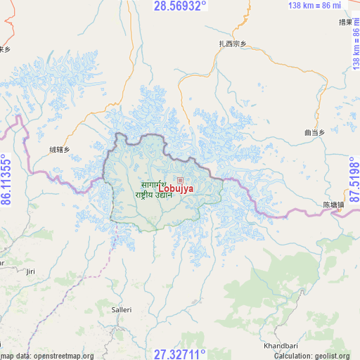
Lobujya GPS coordinates[2]
27° 57' 0" North, 86° 49' 0.012" East
| Map corner | latitude | longitude |
|---|---|---|
| Upper-left | 28.56932°, | 86.11355° |
| Center: | 27.95°, | 86.81667° |
| Lower-right: | 27.32711°, | 87.5198° |
| Map W x H: | 138.1×138.1 km | = 85.8×85.8mi |
| max Lat: | 30.04651° ⇑43.2% North |
| Lobujya: | 27.95° |
| min Lat: | ⇓56.8% South 26.45505° |
| min Long | Lobujya | max Long |
| 80.17715° | 86.81667° | 88.09436° |
| W 87.8%⇐ | ⇒12.2% E |
Elevation
Elevation of Lobujya is 4972 m = 16312 ft, and this is 3796.8 m = 12457 ft above average elevation for this country.
| Max E: |
5251 m = 17228 ft | 1.4% |
| Lobujya | 4972 m 16312 ft | |
| Avg. | 1175.2 m = 3856 ft | |
Min E: |
72 m = 236 ft | 98.6% |
See also: Nepal elevation on elevation.city.
Geographical zone
Lobujya is located in North temperate zone (between Tropic of Cancer and the Arctic Circle). Distance of this Northern Tropic circle is 501.8 km =311.8 mi to South.| Distance of | km | miles | from Lobujya |
|---|---|---|---|
| North Pole | 6899.3 | 4287 | to North |
| Arctic Circle | 4293.4 | 2667.8 | to North |
| Tropic Cancer | 501.8 | 311.8 | to South |
| Equator | 3107.7 | 1931 | to South |


Nearby cities:
15 places around Lobujya: (largest is in red/bold)
• Banepā
132.2 km =82.1 mi,  254°
254°
• Bhojpur
89.5 km =55.6 mi,  165°
165°
• Chhetrapa1
75.3 km =46.8 mi, 246°
• Dhankutā
119 km =73.9 mi,  154°
154°
• Dharān
134.3 km =83.5 mi,  160°
160°
• Dhulikhel
130.5 km =81.1 mi, 253°
• Khanbari
74.5 km =46.3 mi, 148°
• Kothari
84.5 km =52.5 mi,  270°
270°
• Nagarkot
130.1 km =80.8 mi,  258°
258°
• Namche Bazar
19.2 km =11.9 mi,  212°
212°
• Panauti
133.8 km =83.1 mi, 252°
• Panauti̇̄
134.4 km =83.5 mi, 252°
• Rāmechhāp
99.9 km =62.1 mi,  225°
225°
• Triyuga
129.3 km =80.3 mi,  185°
185°
• kankrabari Dovan
138.2 km =85.9 mi, 255°
Sources, notices
• [Note1] Compared only with cities in Nepal existing in our database
• [Src1] Map data: © OpenStreetMap contributors (CC-BY-SA)
• [Src2] Other city data from geonames.org with taken over terms of usage.
• [Src3] Geographical zone / Annual Mean Temperature by Robert A. Rohde @ Wikipedia
