Triyuga geodata
Triyuga (Eastern Region) is a populated locality; located in Nepal in Asia/Kathmandu (GMT+5.75) time zone. With population of 71,405 people, there are 13 cities with bigger population in this country. Compared to other cities in Nepal, 86.5% of cities are located further ↑North; 83.8% of cities are located further ←West and 77% of cities have higher elevation than Triyuga. Note1


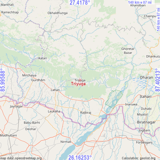
Triyuga GPS coordinates[2]
26° 47' 30.84" North, 86° 41' 56.4" East
| Map corner | latitude | longitude |
|---|---|---|
| Upper-left | 27.4178°, | 85.99588° |
| Center: | 26.7919°, | 86.699° |
| Lower-right: | 26.16253°, | 87.40213° |
| Map W x H: | 139.6×139.6 km | = 86.7×86.7mi |
| max Lat: | 30.04651° ⇑86.5% North |
| Triyuga: | 26.7919° |
| min Lat: | ⇓13.5% South 26.45505° |
| min Long | Triyuga | max Long |
| 80.17715° | 86.699° | 88.09436° |
| W 83.8%⇐ | ⇒16.2% E |
Elevation
Elevation of Triyuga is 165 m = 541 ft, and this is 1010.2 m = 3314 ft below average elevation for this country.
| Max E: |
5251 m = 17228 ft | 77% |
| Avg. | 1175.2 m = 3856 ft | |
| Triyuga | 165 m = 541 ft | |
Min E: |
72 m = 236 ft | 23% |
See also: Triyuga elevation on elevation.city.
Geographical zone
Triyuga is located in North temperate zone (between Tropic of Cancer and the Arctic Circle). Distance of this Northern Tropic circle is 373.1 km =231.8 mi to South.| Distance of | km | miles | from Triyuga |
|---|---|---|---|
| North Pole | 7028.1 | 4367.1 | to North |
| Arctic Circle | 4422.2 | 2747.8 | to North |
| Tropic Cancer | 373.1 | 231.8 | to South |
| Equator | 2979 | 1851.1 | to South |


Nearby cities:
15 places around Triyuga: (largest is in red/bold)
• Bhojpur
54.4 km =33.8 mi,  39°
39°
• Biratnagar
68 km =42.3 mi,  123°
123°
• Dhankutā
66.4 km =41.3 mi,  71°
71°
• Dharān
57.7 km =35.9 mi,  87°
87°
• Inaruwa
49.1 km =30.5 mi,  114°
114°
• Jaleshwar
90.7 km =56.4 mi,  259°
259°
• Janakpur
77 km =47.8 mi, 264°
• Khanbari
82.2 km =51.1 mi, 37°
• Lahān
22.9 km =14.2 mi,  249°
249°
• Malaṅgawā
113.3 km =70.4 mi,  273°
273°
• Namche Bazar
112.7 km =70 mi,  0°
0°
• Rājbirāj
28.5 km =17.7 mi,  170°
170°
• Rāmechhāp
84.8 km =52.7 mi,  314°
314°
• Siraha
51.1 km =31.8 mi, 252°
• Titahari
58.9 km =36.6 mi,  104°
104°
Sources, notices
• [Note1] Compared only with cities in Nepal existing in our database
• [Src1] Map data: © OpenStreetMap contributors (CC-BY-SA)
• [Src2] Other city data from geonames.org with taken over terms of usage.
• [Src3] Geographical zone / Annual Mean Temperature by Robert A. Rohde @ Wikipedia
