Taradale geodata
Taradale (Hawke's Bay) is a section of populated place; located in New Zealand in Pacific/Auckland (GMT+12) time zone. With population of 16,599 people, there are 33 cities with bigger population in this country. Compared to other cities in New Zealand, 52.7% of cities are located further ↓South; 94.7% of cities are located further ←West and 93.7% of cities have higher elevation than Taradale. Note1


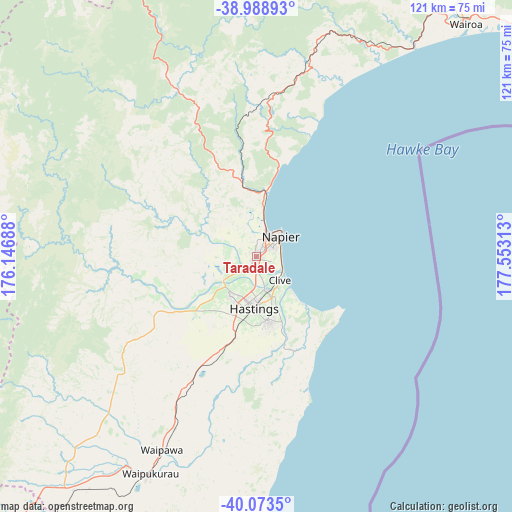
Taradale GPS coordinates[2]
39° 31' 59.988" South, 176° 51' 0" East
| Map corner | latitude | longitude |
|---|---|---|
| Upper-left | -38.98893°, | 176.14688° |
| Center: | -39.53333°, | 176.85° |
| Lower-right: | -40.0735°, | 177.55313° |
| Map W x H: | 120.6×120.6 km | = 74.9×74.9mi |
| max Lat: | -34.99604° ⇑47.3% North |
| Taradale: | -39.53333° |
| min Lat: | ⇓52.7% South -46.6° |
| min Long | Taradale | max Long |
| -176.55973° | 176.85° | 178.33333° |
| W 94.7%⇐ | ⇒5.3% E |
Elevation
Elevation of Taradale is 7 m = 23 ft, and this is 77.4 m = 254 ft below average elevation for this country.
| Max E: |
819 m = 2687 ft | 93.7% |
| Avg. | 84.4 m = 277 ft | |
| Taradale | 7 m = 23 ft | |
Min E: |
3 m = 10 ft | 6.3% |
See also: New Zealand elevation on elevation.city.
Geographical zone
Taradale is located in South temperate zone (between Tropic of Capricorn and the Antarctic Circle). Distance of this Southern Tropic circle is 1789.8 km =1112.1 mi to North.| Distance of | km | miles | from Taradale |
|---|---|---|---|
| Equator | 4395.7 | 2731.4 | to North |
| Tropic Capricorn | 1789.8 | 1112.1 | to North |
| Antarctic Circle | 3005.5 | 1867.5 | to South |
| South Pole | 5611.4 | 3486.8 | to South |


Nearby cities:
15 places around Taradale: (largest is in red/bold)
• Gisborne
139.6 km =86.7 mi,  45°
45°
• Hastings
11.6 km =7.2 mi,  180°
180°
• Hunterville
118.4 km =73.6 mi,  247°
247°
• Manutuke
131.9 km =82 mi,  44°
44°
• Murupara
119.3 km =74.1 mi,  353°
353°
• Napier
7 km =4.3 mi, 49°
• Otane
43.1 km =26.8 mi,  205°
205°
• Palmerston North
139.7 km =86.8 mi,  229°
229°
• Reporoa
129.7 km =80.6 mi,  340°
340°
• Sanson
143.6 km =89.2 mi,  237°
237°
• Takapau
70.1 km =43.6 mi,  217°
217°
• Taupo
115.4 km =71.7 mi,  325°
325°
• Turangi
108.1 km =67.2 mi,  303°
303°
• Waiouru
101.6 km =63.1 mi,  273°
273°
• Wairoa
71.2 km =44.2 mi, 38°
Sources, notices
• [Note1] Compared only with cities in New Zealand existing in our database
• [Src1] Map data: © OpenStreetMap contributors (CC-BY-SA)
• [Src2] Other city data from geonames.org with taken over terms of usage.
• [Src3] Geographical zone / Annual Mean Temperature by Robert A. Rohde @ Wikipedia
