Bahlā’ geodata
Bahlā’ (Ad Dakhiliyah) is a populated place; located in Oman in Asia/Muscat (GMT+4) time zone. With population of 54,338 people, there are 13 cities with bigger population in this country. Compared to other cities in Oman, 67.7% of cities are located further ↑North; 54.8% of cities are located further →East and 96.8% of cities have lower elevation than Bahlā’. Note1


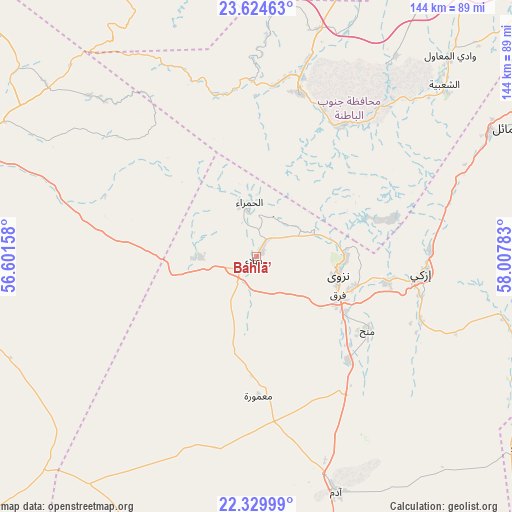
Bahlā’ GPS coordinates[2]
22° 58' 43.896" North, 57° 18' 16.92" East
| Map corner | latitude | longitude |
|---|---|---|
| Upper-left | 23.62463°, | 56.60158° |
| Center: | 22.97886°, | 57.3047° |
| Lower-right: | 22.32999°, | 58.00783° |
| Map W x H: | 144×144 km | = 89.5×89.5mi |
| max Lat: | 26.19778° ⇑67.7% North |
| Bahlā’: | 22.97886° |
| min Lat: | ⇓32.3% South 17.01505° |
| min Long | Bahlā’ | max Long |
| 52.66042° | 57.3047° | 59.52889° |
| W 45.2%⇐ | ⇒54.8% E |
Elevation
Elevation of Bahlā’ is 567 m = 1860 ft, and this is 360.3 m = 1182 ft above average elevation for this country.
| Max E: |
684 m = 2244 ft | 3.2% |
| Bahlā’ | 567 m 1860 ft | |
| Avg. | 206.7 m = 678 ft | |
Min E: |
1 m = 3 ft | 96.8% |
See also: Bahlā’ elevation on elevation.city.
Geographical zone
Bahlā’ is located in North Torrid zone (between Equator and Tropic of Cancer). Distance of this Northern Tropic circle is 50.9 km =31.6 mi to North.| Distance of | km | miles | from Bahlā’ |
|---|---|---|---|
| North Pole | 7452.1 | 4630.5 | to North |
| Arctic Circle | 4846.2 | 3011.3 | to North |
| Tropic Cancer | 50.9 | 31.6 | to North |
| Equator | 2555 | 1587.6 | to South |


Nearby cities:
15 places around Bahlā’: (largest is in red/bold)
• Adam
70.5 km =43.8 mi,  161°
161°
• Al Khābūrah
112.5 km =69.9 mi,  348°
348°
• As Suwayq
97.8 km =60.8 mi,  8°
8°
• Barkā’
97.9 km =60.8 mi,  37°
37°
• Bayt al ‘Awābī
42.5 km =26.4 mi,  31°
31°
• Bidbid
96.8 km =60.1 mi,  60°
60°
• Ibrā’
129.9 km =80.7 mi,  104°
104°
• Izkī
47.6 km =29.6 mi, 96°
• Nizwá
23.9 km =14.9 mi, 102°
• Oman Smart Future City
80.7 km =50.1 mi,  21°
21°
• Rustaq
47.4 km =29.5 mi, 14°
• Seeb
118.6 km =73.7 mi,  49°
49°
• Sufālat Samā’il
81.9 km =50.9 mi, 62°
• Yanqul
103.3 km =64.2 mi,  310°
310°
• ‘Ibrī
85.2 km =52.9 mi,  288°
288°
Sources, notices
• [Note1] Compared only with cities in Oman existing in our database
• [Src1] Map data: © OpenStreetMap contributors (CC-BY-SA)
• [Src2] Other city data from geonames.org with taken over terms of usage.
• [Src3] Geographical zone / Annual Mean Temperature by Robert A. Rohde @ Wikipedia
