Bayt al ‘Awābī geodata
Bayt al ‘Awābī (Al Batinah South) is a section of populated place; located in Oman in Asia/Muscat (GMT+4) time zone. With population of 10,711 people, there are 27 cities with bigger population in this country. Compared to other cities in Oman, 61.3% of cities are located further ↑North; 54.8% of cities are located further ←West and 83.9% of cities have lower elevation than Bayt al ‘Awābī. Note1


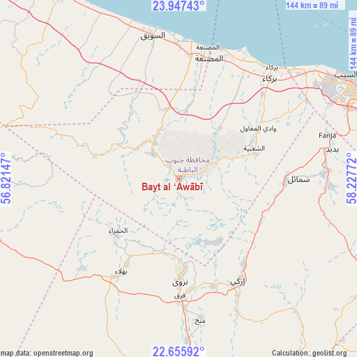
Bayt al ‘Awābī GPS coordinates[2]
23° 18' 11.664" North, 57° 31' 28.524" East
| Map corner | latitude | longitude |
|---|---|---|
| Upper-left | 23.94743°, | 56.82147° |
| Center: | 23.30324°, | 57.52459° |
| Lower-right: | 22.65592°, | 58.22772° |
| Map W x H: | 143.6×143.6 km | = 89.2×89.2mi |
| max Lat: | 26.19778° ⇑61.3% North |
| Bayt al ‘Awābī: | 23.30324° |
| min Lat: | ⇓38.7% South 17.01505° |
| min Long | Bayt al ‘Awā | max Long |
| 52.66042° | 57.52459° | 59.52889° |
| W 54.8%⇐ | ⇒45.2% E |
Elevation
Elevation of Bayt al ‘Awābī is 493 m = 1617 ft, and this is 286.3 m = 939 ft above average elevation for this country.
| Max E: |
684 m = 2244 ft | 16.1% |
| Bayt al ‘Awābī | 493 m 1617 ft | |
| Avg. | 206.7 m = 678 ft | |
Min E: |
1 m = 3 ft | 83.9% |
See also: Oman elevation on elevation.city.
Geographical zone
Bayt al ‘Awābī is located in North Torrid zone (between Equator and Tropic of Cancer). Distance of this Northern Tropic circle is 14.8 km =9.2 mi to North.| Distance of | km | miles | from Bayt al ‘Awābī |
|---|---|---|---|
| North Pole | 7416 | 4608.1 | to North |
| Arctic Circle | 4810.1 | 2988.9 | to North |
| Tropic Cancer | 14.8 | 9.2 | to North |
| Equator | 2591.1 | 1610 | to South |


Nearby cities:
15 places around Bayt al ‘Awābī: (largest is in red/bold)
• Adam
102.7 km =63.8 mi,  179°
179°
• Al Khābūrah
86.3 km =53.6 mi,  329°
329°
• As Suwayq
61.4 km =38.2 mi,  351°
351°
• Bahlā’
42.5 km =26.4 mi,  211°
211°
• Barkā’
55.7 km =34.6 mi,  41°
41°
• Bawshar
94.4 km =58.7 mi,  71°
71°
• Bidbid
62.7 km =39 mi,  79°
79°
• Izkī
48 km =29.8 mi,  148°
148°
• Muscat
95.4 km =59.3 mi, 70°
• Nizwá
41.1 km =25.5 mi, 178°
• Oman Smart Future City
39.6 km =24.6 mi,  11°
11°
• Rustaq
14.1 km =8.8 mi,  313°
313°
• Seeb
79.1 km =49.2 mi,  58°
58°
• Sufālat Samā’il
50.3 km =31.3 mi,  88°
88°
• ‘Ibrī
103.4 km =64.2 mi,  265°
265°
Sources, notices
• [Note1] Compared only with cities in Oman existing in our database
• [Src1] Map data: © OpenStreetMap contributors (CC-BY-SA)
• [Src2] Other city data from geonames.org with taken over terms of usage.
• [Src3] Geographical zone / Annual Mean Temperature by Robert A. Rohde @ Wikipedia
