‘Ibrī geodata
‘Ibrī (Az̧ Z̧āhirah) is a populated place; located in Oman in Asia/Muscat (GMT+4) time zone. With population of 101,640 people, there are 6 cities with bigger population in this country. Compared to other cities in Oman, 64.5% of cities are located further ↑North; 74.2% of cities are located further →East and 77.4% of cities have lower elevation than ‘Ibrī. Note1


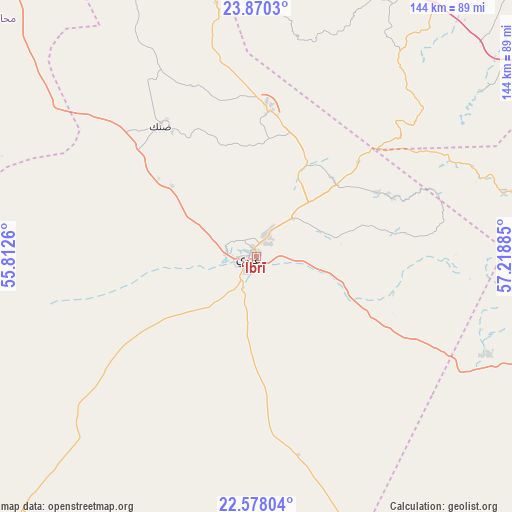
‘Ibrī GPS coordinates[2]
23° 13' 32.628" North, 56° 30' 56.592" East
| Map corner | latitude | longitude |
|---|---|---|
| Upper-left | 23.8703°, | 55.8126° |
| Center: | 23.22573°, | 56.51572° |
| Lower-right: | 22.57804°, | 57.21885° |
| Map W x H: | 143.7×143.7 km | = 89.3×89.3mi |
| max Lat: | 26.19778° ⇑64.5% North |
| ‘Ibrī: | 23.22573° |
| min Lat: | ⇓35.5% South 17.01505° |
| min Long | ‘Ibrī | max Long |
| 52.66042° | 56.51572° | 59.52889° |
| W 25.8%⇐ | ⇒74.2% E |
Elevation
Elevation of ‘Ibrī is 359 m = 1178 ft, and this is 152.3 m = 500 ft above average elevation for this country.
| Max E: |
684 m = 2244 ft | 22.6% |
| ‘Ibrī | 359 m 1178 ft | |
| Avg. | 206.7 m = 678 ft | |
Min E: |
1 m = 3 ft | 77.4% |
See also: ‘Ibrī elevation on elevation.city.
Geographical zone
‘Ibrī is located in North Torrid zone (between Equator and Tropic of Cancer). Distance of this Northern Tropic circle is 23.5 km =14.6 mi to North.| Distance of | km | miles | from ‘Ibrī |
|---|---|---|---|
| North Pole | 7424.6 | 4613.4 | to North |
| Arctic Circle | 4818.7 | 2994.2 | to North |
| Tropic Cancer | 23.5 | 14.6 | to North |
| Equator | 2582.5 | 1604.7 | to South |


Nearby cities:
15 places around ‘Ibrī: (largest is in red/bold)
• Adam
140 km =87 mi,  132°
132°
• Al Buraymī
135.7 km =84.3 mi,  327°
327°
• Al Khābūrah
101.7 km =63.2 mi,  35°
35°
• As Suwayq
116.9 km =72.6 mi,  53°
53°
• Bahlā’
85.2 km =52.9 mi,  108°
108°
• Barkā’
148.6 km =92.3 mi,  70°
70°
• Bayt al ‘Awābī
103.4 km =64.2 mi,  85°
85°
• Izkī
132 km =82 mi,  104°
104°
• Liwá
145.2 km =90.2 mi,  1°
1°
• Nizwá
109.1 km =67.8 mi, 107°
• Oman Smart Future City
120.3 km =74.8 mi, 66°
• Rustaq
94.6 km =58.8 mi,  78°
78°
• Sohar
126.3 km =78.5 mi,  8°
8°
• Yanqul
40.2 km =25 mi, 3°
• Şaḩam
111.9 km =69.5 mi,  19°
19°
Sources, notices
• [Note1] Compared only with cities in Oman existing in our database
• [Src1] Map data: © OpenStreetMap contributors (CC-BY-SA)
• [Src2] Other city data from geonames.org with taken over terms of usage.
• [Src3] Geographical zone / Annual Mean Temperature by Robert A. Rohde @ Wikipedia
