Al Khābūrah geodata
Al Khābūrah (Al Batinah North) is a populated place; located in Oman in Asia/Muscat (GMT+4) time zone. With population of 50,223 people, there are 14 cities with bigger population in this country. Compared to other cities in Oman, 74.2% of cities are located further ↓South; 58.1% of cities are located further →East and 90.3% of cities have higher elevation than Al Khābūrah. Note1


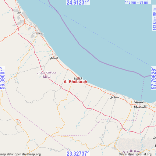
Al Khābūrah GPS coordinates[2]
23° 58' 17.184" North, 57° 5' 35.268" East
| Map corner | latitude | longitude |
|---|---|---|
| Upper-left | 24.61231°, | 56.39001° |
| Center: | 23.97144°, | 57.09313° |
| Lower-right: | 23.32737°, | 57.79626° |
| Map W x H: | 142.9×142.9 km | = 88.8×88.8mi |
| max Lat: | 26.19778° ⇑25.8% North |
| Al Khābūrah: | 23.97144° |
| min Lat: | ⇓74.2% South 17.01505° |
| min Long | Al Khābūrah | max Long |
| 52.66042° | 57.09313° | 59.52889° |
| W 41.9%⇐ | ⇒58.1% E |
Elevation
Elevation of Al Khābūrah is 4 m = 13 ft, and this is 202.7 m = 665 ft below average elevation for this country.
| Max E: |
684 m = 2244 ft | 90.3% |
| Avg. | 206.7 m = 678 ft | |
| Al Khābūrah | 4 m = 13 ft | |
Min E: |
1 m = 3 ft | 9.7% |
See also: Al Khābūrah elevation on elevation.city.
Geographical zone
Al Khābūrah is located in North temperate zone (between Tropic of Cancer and the Arctic Circle). Distance of this Northern Tropic circle is 59.5 km =37 mi to South.| Distance of | km | miles | from Al Khābūrah |
|---|---|---|---|
| North Pole | 7341.7 | 4561.9 | to North |
| Arctic Circle | 4735.8 | 2942.7 | to North |
| Tropic Cancer | 59.5 | 37 | to South |
| Equator | 2665.4 | 1656.2 | to South |


Nearby cities:
15 places around Al Khābūrah: (largest is in red/bold)
• As Suwayq
37.6 km =23.4 mi,  111°
111°
• Bahlā’
112.5 km =69.9 mi,  168°
168°
• Barkā’
87 km =54.1 mi, 111°
• Bayt al ‘Awābī
86.3 km =53.6 mi,  149°
149°
• Bidbid
122.6 km =76.2 mi,  120°
120°
• Liwá
82.2 km =51.1 mi,  319°
319°
• Oman Smart Future City
62.5 km =38.8 mi, 124°
• Rustaq
72.8 km =45.2 mi, 152°
• Seeb
116.4 km =72.3 mi, 106°
• Shināş
106.7 km =66.3 mi, 323°
• Sohar
57.1 km =35.5 mi, 317°
• Sufālat Samā’il
118.9 km =73.9 mi,  127°
127°
• Yanqul
70.7 km =43.9 mi,  232°
232°
• Şaḩam
30.5 km =19 mi, 317°
• ‘Ibrī
101.7 km =63.2 mi,  215°
215°
Sources, notices
• [Note1] Compared only with cities in Oman existing in our database
• [Src1] Map data: © OpenStreetMap contributors (CC-BY-SA)
• [Src2] Other city data from geonames.org with taken over terms of usage.
• [Src3] Geographical zone / Annual Mean Temperature by Robert A. Rohde @ Wikipedia
