Oman Smart Future City geodata
Oman Smart Future City (Al Batinah South) is a farm village; located in Oman in Asia/Muscat (GMT+4) time zone. With population of 25,000 people, there are 20 cities with bigger population in this country. Compared to other cities in Oman, 61.3% of cities are located further ↓South; 64.5% of cities are located further ←West and 51.6% of cities have higher elevation than Oman Smart Future City. Note1
Current local time in Oman Smart Future City:
07:32 PM, TuesdayDifference from your time zone: hours


Oman Smart Future City GPS coordinates[2]
23° 39' 9.72" North, 57° 35' 57.336" East
| Map corner | latitude | longitude |
|---|---|---|
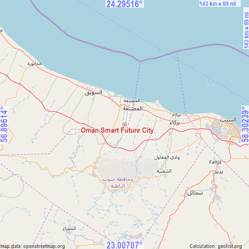
| Upper-left | 24.29516°, | 56.89614° |
| Center: | 23.6527°, | 57.59926° |
| Lower-right: | 23.00707°, | 58.30239° |
| Map W x H: | 143.2×143.2 km | = 89×89mi |
| max Lat: | 26.19778° ⇑38.7% North |
| Oman Smart Future City: | 23.6527° |
| min Lat: | ⇓61.3% South 17.01505° |
| min Long | Oman Smart Futu | max Long |
| 52.66042° | 57.59926° | 59.52889° |
| W 64.5%⇐ | ⇒35.5% E |
Elevation
Elevation of Oman Smart Future City is 69 m = 226 ft, and this is 137.7 m = 452 ft below average elevation for this country.
| Max E: |
684 m = 2244 ft | 51.6% |
| Avg. | 206.7 m = 678 ft | |
| Oman Smart Future City | 69 m = 226 ft | |
Min E: |
1 m = 3 ft | 48.4% |
See also: Oman elevation on elevation.city.
Geographical zone
Oman Smart Future City is located in North temperate zone (between Tropic of Cancer and the Arctic Circle). Distance of this Northern Tropic circle is 24 km =14.9 mi to South.| Distance of | km | miles | from Oman Smart Future City |
|---|---|---|---|
| North Pole | 7377.1 | 4583.9 | to North |
| Arctic Circle | 4771.2 | 2964.7 | to North |
| Tropic Cancer | 24 | 14.9 | to South |
| Equator | 2629.9 | 1634.1 | to South |


Nearby cities:
15 places around Oman Smart Future City: (largest is in red/bold)
• Al Khābūrah
62.5 km =38.8 mi,  304°
304°
• As Suwayq
27.3 km =17 mi,  323°
323°
• Bahlā’
80.7 km =50.1 mi,  201°
201°
• Barkā’
29.3 km =18.2 mi,  84°
84°
• Bawshar
82 km =51 mi,  95°
95°
• Bayt al ‘Awābī
39.6 km =24.6 mi,  191°
191°
• Bidbid
60.4 km =37.5 mi,  116°
116°
• Izkī
81.8 km =50.8 mi,  167°
167°
• Muscat
82.7 km =51.4 mi, 95°
• Nizwá
80.3 km =49.9 mi,  184°
184°
• Rustaq
34.1 km =21.2 mi,  211°
211°
• Seeb
60.1 km =37.3 mi,  88°
88°
• Sufālat Samā’il
56.6 km =35.2 mi,  131°
131°
• Yanqul
108.2 km =67.2 mi,  266°
266°
• Şaḩam
92.5 km =57.5 mi,  308°
308°
Sources, notices
• [Note1] Compared only with cities in Oman existing in our database
• [Src1] Map data: © OpenStreetMap contributors (CC-BY-SA)
• [Src2] Other city data from geonames.org with taken over terms of usage.
• [Src3] Geographical zone / Annual Mean Temperature by Robert A. Rohde @ Wikipedia
