Gonzalo Vásquez geodata
Gonzalo Vásquez (Panamá) is a seat of a third-order administrative division; located in Panama in America/Panama (GMT-5) time zone. In our database, there are 694 cities with bigger population. Compared to other cities in Panama, 56.4% of cities are located further ↑North; 93.8% of cities are located further ←West and 94.7% of cities have higher elevation than Gonzalo Vásquez. Note1


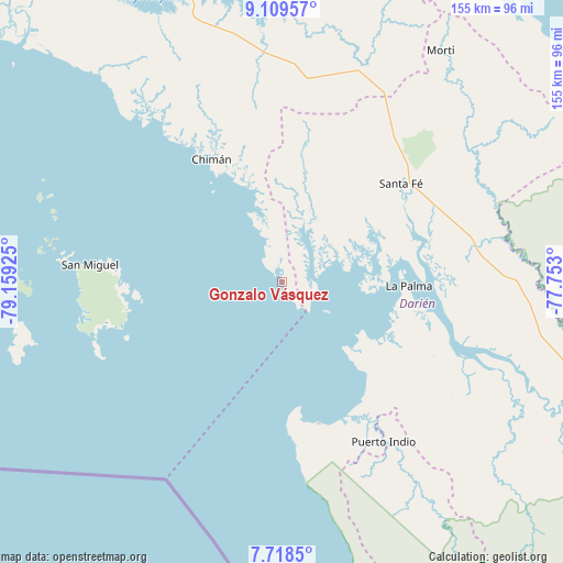
Gonzalo Vásquez GPS coordinates[2]
8° 24' 52.776" North, 78° 27' 22.032" West
| Map corner | latitude | longitude |
|---|---|---|
| Upper-left | 9.10957°, | -79.15925° |
| Center: | 8.41466°, | -78.45612° |
| Lower-right: | 7.7185°, | -77.753° |
| Map W x H: | 154.7×154.7 km | = 96.1×96.1mi |
| max Lat: | 9.60898° ⇑56.4% North |
| Gonzalo Vásquez: | 8.41466° |
| min Lat: | ⇓43.6% South 7.26534° |
| min Long | Gonzalo Vásque | max Long |
| -82.91275° | -78.45612° | -77.38965° |
| W 93.8%⇐ | ⇒6.2% E |
Elevation
Elevation of Gonzalo Vásquez is 8 m = 26 ft, and this is 164.1 m = 538 ft below average elevation for this country.
| Max E: |
2103 m = 6900 ft | 94.7% |
| Avg. | 172.1 m = 565 ft | |
| Gonzalo Vásquez | 8 m = 26 ft | |
Min E: |
-1 m = -3 ft | 5.3% |
See also: Panama elevation on elevation.city.
Geographical zone
Gonzalo Vásquez is located in North Torrid zone (between Equator and Tropic of Cancer). Distance of Equator is 935.6 km =581.4 mi to South.| Distance of | km | miles | from Gonzalo Vásquez |
|---|---|---|---|
| North Pole | 9071.4 | 5636.7 | to North |
| Arctic Circle | 6465.6 | 4017.5 | to North |
| Tropic Cancer | 1670.3 | 1037.9 | to North |
| Equator | 935.6 | 581.4 | to South |


Nearby cities:
15 places around Gonzalo Vásquez: (largest is in red/bold)
• Barriales
20.3 km =12.6 mi,  21°
21°
• Brujas
20.6 km =12.8 mi,  336°
336°
• Chepigana
46.7 km =29 mi,  107°
107°
• Chimán
36.5 km =22.7 mi,  327°
327°
• Cucunatí
28.3 km =17.6 mi,  50°
50°
• Garachiné
40 km =24.9 mi,  165°
165°
• La Ensenada
43.2 km =26.8 mi,  262°
262°
• La Palma
34.8 km =21.6 mi,  91°
91°
• Platanilla
46.6 km =29 mi,  9°
9°
• Pueblo Nuevo
37.1 km =23.1 mi,  142°
142°
• Punta Alegre
25.9 km =16.1 mi,  120°
120°
• Quebrada Honda
45 km =28 mi,  56°
56°
• Santa Fé
42 km =26.1 mi, 50°
• Setegantí
41.4 km =25.7 mi, 108°
• Zapallal
44.4 km =27.6 mi, 53°
Sources, notices
• [Note1] Compared only with cities in Panama existing in our database
• [Src1] Map data: © OpenStreetMap contributors (CC-BY-SA)
• [Src2] Other city data from geonames.org with taken over terms of usage.
• [Src3] Geographical zone / Annual Mean Temperature by Robert A. Rohde @ Wikipedia
