Barrio Guadalupe geodata
Barrio Guadalupe (Chiriquí) is a populated place; located in Panama in America/Panama (GMT-5) time zone. With population of 1,019 people, there are 252 cities with bigger population in this country. Compared to other cities in Panama, 77.7% of cities are located further ↓South; 90.6% of cities are located further →East and 100% of cities have lower elevation than Barrio Guadalupe. Note1


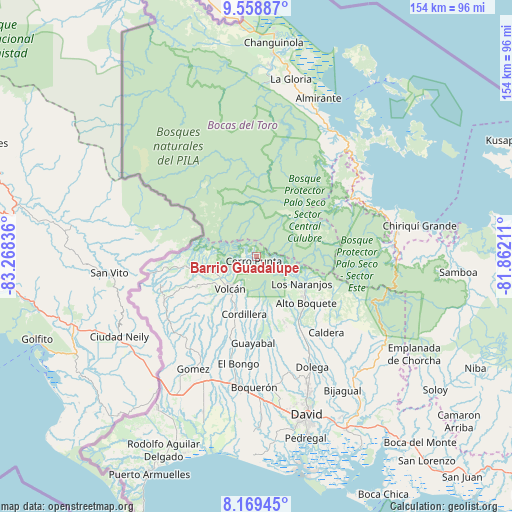
Barrio Guadalupe GPS coordinates[2]
8° 51' 53.352" North, 82° 33' 54.828" West
| Map corner | latitude | longitude |
|---|---|---|
| Upper-left | 9.55887°, | -83.26836° |
| Center: | 8.86482°, | -82.56523° |
| Lower-right: | 8.16945°, | -81.86211° |
| Map W x H: | 154.5×154.5 km | = 96×96mi |
| max Lat: | 9.60898° ⇑22.3% North |
| Barrio Guadalupe: | 8.86482° |
| min Lat: | ⇓77.7% South 7.26534° |
| min Long | Barrio Guadalup | max Long |
| -82.91275° | -82.56523° | -77.38965° |
| W 9.4%⇐ | ⇒90.6% E |
Elevation
Elevation of Barrio Guadalupe is 2103 m = 6900 ft, and this is 1930.9 m = 6335 ft above average elevation for this country.
| Max E: |
2103 m = 6900 ft | 0% |
| Barrio Guadalupe | 2103 m 6900 ft | |
| Avg. | 172.1 m = 565 ft | |
Min E: |
-1 m = -3 ft | 100% |
See also: Panama elevation on elevation.city.
Geographical zone
Barrio Guadalupe is located in North Torrid zone (between Equator and Tropic of Cancer). Distance of Equator is 985.7 km =612.5 mi to South.| Distance of | km | miles | from Barrio Guadalupe |
|---|---|---|---|
| North Pole | 9021.4 | 5605.6 | to North |
| Arctic Circle | 6415.5 | 3986.4 | to North |
| Tropic Cancer | 1620.2 | 1006.7 | to North |
| Equator | 985.7 | 612.5 | to South |


Nearby cities:
15 places around Barrio Guadalupe: (largest is in red/bold)
• Alto Boquete
20.6 km =12.8 mi,  134°
134°
• Alto Lino
16.1 km =10 mi,  116°
116°
• Alto Quiel
12 km =7.5 mi, 123°
• Bajo Boquete
17.9 km =11.1 mi, 125°
• Boquete
16.5 km =10.3 mi, 124°
• Cerro Punta
1.9 km =1.2 mi,  205°
205°
• Cordillera
18.1 km =11.2 mi,  193°
193°
• El Banco
20.1 km =12.5 mi,  163°
163°
• Jaramillo Arriba
17.2 km =10.7 mi, 115°
• Los Naranjos
15.3 km =9.5 mi, 121°
• Palmira
18.7 km =11.6 mi,  141°
141°
• Palmira Centro
18.7 km =11.6 mi, 138°
• Piedra Candela
20.8 km =12.9 mi,  274°
274°
• Potrerillos Arriba
21.5 km =13.4 mi, 157°
• Volcán
13 km =8.1 mi,  218°
218°
Sources, notices
• [Note1] Compared only with cities in Panama existing in our database
• [Src1] Map data: © OpenStreetMap contributors (CC-BY-SA)
• [Src2] Other city data from geonames.org with taken over terms of usage.
• [Src3] Geographical zone / Annual Mean Temperature by Robert A. Rohde @ Wikipedia
