Pocrí geodata
Pocrí (Los Santos) is a seat of a second-order administrative division; located in Panama in America/Panama (GMT-5) time zone. With population of 494 people, there are 492 cities with bigger population in this country. Compared to other cities in Panama, 95.7% of cities are located further ↑North; 70.2% of cities are located further ←West and 61.3% of cities have higher elevation than Pocrí. Note1


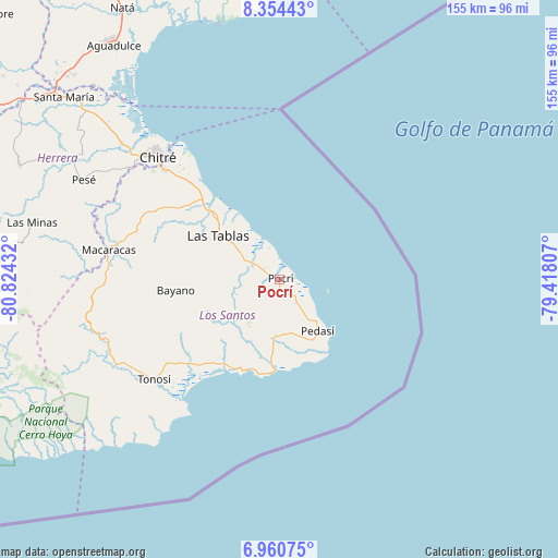
Pocrí GPS coordinates[2]
7° 39' 29.376" North, 80° 7' 16.284" West
| Map corner | latitude | longitude |
|---|---|---|
| Upper-left | 8.35443°, | -80.82432° |
| Center: | 7.65816°, | -80.12119° |
| Lower-right: | 6.96075°, | -79.41807° |
| Map W x H: | 155×155 km | = 96.3×96.3mi |
| max Lat: | 9.60898° ⇑95.7% North |
| Pocrí: | 7.65816° |
| min Lat: | ⇓4.3% South 7.26534° |
| min Long | Pocrí | max Long |
| -82.91275° | -80.12119° | -77.38965° |
| W 70.2%⇐ | ⇒29.8% E |
Elevation
Elevation of Pocrí is 50 m = 164 ft, and this is 122.1 m = 401 ft below average elevation for this country.
| Max E: |
2103 m = 6900 ft | 61.3% |
| Avg. | 172.1 m = 565 ft | |
| Pocrí | 50 m = 164 ft | |
Min E: |
-1 m = -3 ft | 38.7% |
See also: Panama elevation on elevation.city.
Geographical zone
Pocrí is located in North Torrid zone (between Equator and Tropic of Cancer). Distance of Equator is 851.5 km =529.1 mi to South.| Distance of | km | miles | from Pocrí |
|---|---|---|---|
| North Pole | 9155.6 | 5689 | to North |
| Arctic Circle | 6549.7 | 4069.8 | to North |
| Tropic Cancer | 1754.4 | 1090.1 | to North |
| Equator | 851.5 | 529.1 | to South |


Nearby cities:
15 places around Pocrí: (largest is in red/bold)
• Bajo Corral
16.4 km =10.2 mi,  248°
248°
• Bella Vista
16 km =9.9 mi,  309°
309°
• El Cañafístulo
13.1 km =8.1 mi, 249°
• La Laja
16.6 km =10.3 mi,  299°
299°
• La Palma
9 km =5.6 mi,  292°
292°
• Lajamina
8.1 km =5 mi,  188°
188°
• Los Asientos
15.8 km =9.8 mi, 185°
• Mariabé
10.4 km =6.5 mi,  144°
144°
• Paraíso
5.3 km =3.3 mi, 304°
• Paritilla
6.5 km =4 mi,  239°
239°
• Pedasí
17.6 km =10.9 mi, 143°
• Peña Blanca
19.2 km =11.9 mi, 290°
• San José
13.7 km =8.5 mi,  277°
277°
• Santo Domingo
16.5 km =10.3 mi, 306°
• Sesteadero
16.7 km =10.4 mi, 302°
Sources, notices
• [Note1] Compared only with cities in Panama existing in our database
• [Src1] Map data: © OpenStreetMap contributors (CC-BY-SA)
• [Src2] Other city data from geonames.org with taken over terms of usage.
• [Src3] Geographical zone / Annual Mean Temperature by Robert A. Rohde @ Wikipedia
