Los Olivos geodata
Los Olivos (Los Santos) is a seat of a third-order administrative division; located in Panama in America/Panama (GMT-5) time zone. With population of 618 people, there are 400 cities with bigger population in this country. Compared to other cities in Panama, 85.9% of cities are located further ↑North; 53.8% of cities are located further ←West and 72.4% of cities have higher elevation than Los Olivos. Note1


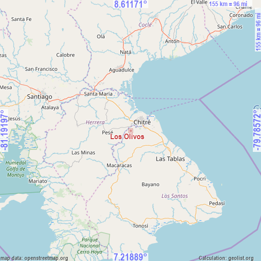
Los Olivos GPS coordinates[2]
7° 54' 57.204" North, 80° 29' 19.824" West
| Map corner | latitude | longitude |
|---|---|---|
| Upper-left | 8.61171°, | -81.19197° |
| Center: | 7.91589°, | -80.48884° |
| Lower-right: | 7.21889°, | -79.78572° |
| Map W x H: | 154.9×154.9 km | = 96.3×96.3mi |
| max Lat: | 9.60898° ⇑85.9% North |
| Los Olivos: | 7.91589° |
| min Lat: | ⇓14.1% South 7.26534° |
| min Long | Los Olivos | max Long |
| -82.91275° | -80.48884° | -77.38965° |
| W 53.8%⇐ | ⇒46.2% E |
Elevation
Elevation of Los Olivos is 33 m = 108 ft, and this is 139.1 m = 456 ft below average elevation for this country.
| Max E: |
2103 m = 6900 ft | 72.4% |
| Avg. | 172.1 m = 565 ft | |
| Los Olivos | 33 m = 108 ft | |
Min E: |
-1 m = -3 ft | 27.6% |
See also: Panama elevation on elevation.city.
Geographical zone
Los Olivos is located in North Torrid zone (between Equator and Tropic of Cancer). Distance of Equator is 880.2 km =546.9 mi to South.| Distance of | km | miles | from Los Olivos |
|---|---|---|---|
| North Pole | 9126.9 | 5671.2 | to North |
| Arctic Circle | 6521 | 4052 | to North |
| Tropic Cancer | 1725.8 | 1072.4 | to North |
| Equator | 880.2 | 546.9 | to South |


Nearby cities:
15 places around Los Olivos: (largest is in red/bold)
• Boca de Parita
11 km =6.8 mi,  20°
20°
• Chitré
8.2 km =5.1 mi,  52°
52°
• El Barrero
3.4 km =2.1 mi,  305°
305°
• El Ejido
11.2 km =7 mi,  89°
89°
• El Pájaro
9.5 km =5.9 mi,  288°
288°
• La Arena
6.3 km =3.9 mi, 24°
• Las Cabras
8 km =5 mi,  235°
235°
• Las Guabas
11.3 km =7 mi,  187°
187°
• Llano Bonito
10.4 km =6.5 mi, 49°
• Llano Largo
7 km =4.3 mi,  98°
98°
• Los Hatillos
5.7 km =3.5 mi, 286°
• Los Santos
8.2 km =5.1 mi,  76°
76°
• Monagrillo
9.2 km =5.7 mi,  37°
37°
• Parita
9.4 km =5.8 mi,  337°
337°
• San Juan Bautista
9.8 km =6.1 mi,  59°
59°
Sources, notices
• [Note1] Compared only with cities in Panama existing in our database
• [Src1] Map data: © OpenStreetMap contributors (CC-BY-SA)
• [Src2] Other city data from geonames.org with taken over terms of usage.
• [Src3] Geographical zone / Annual Mean Temperature by Robert A. Rohde @ Wikipedia
