Los Llanitos geodata
Los Llanitos (Panamá Oeste) is a seat of a third-order administrative division; located in Panama in America/Panama (GMT-5) time zone. With population of 146 people, there are 633 cities with bigger population in this country. Compared to other cities in Panama, 63.7% of cities are located further ↓South; 70.5% of cities are located further ←West and 95.2% of cities have lower elevation than Los Llanitos. Note1


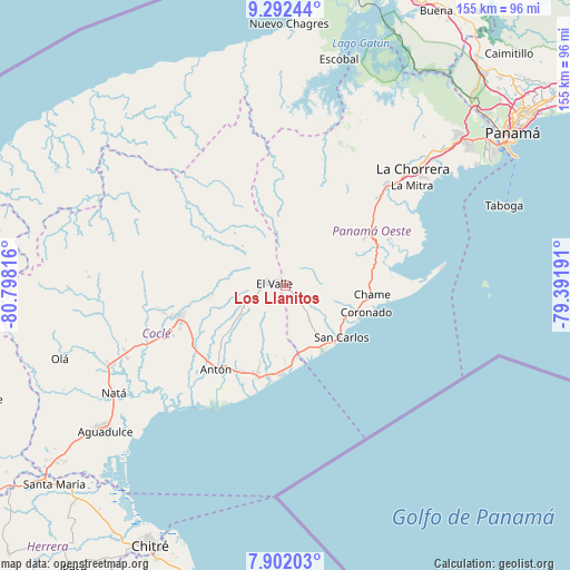
Los Llanitos GPS coordinates[2]
8° 35' 52.332" North, 80° 5' 42.108" West
| Map corner | latitude | longitude |
|---|---|---|
| Upper-left | 9.29244°, | -80.79816° |
| Center: | 8.59787°, | -80.09503° |
| Lower-right: | 7.90203°, | -79.39191° |
| Map W x H: | 154.6×154.6 km | = 96.1×96.1mi |
| max Lat: | 9.60898° ⇑36.3% North |
| Los Llanitos: | 8.59787° |
| min Lat: | ⇓63.7% South 7.26534° |
| min Long | Los Llanitos | max Long |
| -82.91275° | -80.09503° | -77.38965° |
| W 70.5%⇐ | ⇒29.5% E |
Elevation
Elevation of Los Llanitos is 692 m = 2270 ft, and this is 519.9 m = 1706 ft above average elevation for this country.
| Max E: |
2103 m = 6900 ft | 4.8% |
| Los Llanitos | 692 m 2270 ft | |
| Avg. | 172.1 m = 565 ft | |
Min E: |
-1 m = -3 ft | 95.2% |
See also: Panama elevation on elevation.city.
Geographical zone
Los Llanitos is located in North Torrid zone (between Equator and Tropic of Cancer). Distance of Equator is 956 km =594 mi to South.| Distance of | km | miles | from Los Llanitos |
|---|---|---|---|
| North Pole | 9051.1 | 5624.1 | to North |
| Arctic Circle | 6445.2 | 4004.9 | to North |
| Tropic Cancer | 1649.9 | 1025.2 | to North |
| Equator | 956 | 594 | to South |


Nearby cities:
15 places around Los Llanitos: (largest is in red/bold)
• Alto de La Estancia
9.9 km =6.2 mi,  263°
263°
• Caballero
12.8 km =8 mi,  241°
241°
• Cabuya
9.8 km =6.1 mi,  234°
234°
• Chiguirí Arriba
13.3 km =8.3 mi,  308°
308°
• Entradero
12.8 km =8 mi, 255°
• Guayabito
10.5 km =6.5 mi,  121°
121°
• La Laguna
5.3 km =3.3 mi,  82°
82°
• Las Colinas
5.5 km =3.4 mi,  166°
166°
• Las Matas
14.3 km =8.9 mi,  178°
178°
• Mata Ahogado
2.2 km =1.4 mi,  1°
1°
• Membrillo
13.1 km =8.1 mi, 262°
• Sofre
13.5 km =8.4 mi,  278°
278°
• Sorá
10.2 km =6.3 mi,  68°
68°
• Tavidal Arriba
12.9 km =8 mi,  316°
316°
• Turega
11.1 km =6.9 mi, 278°
Sources, notices
• [Note1] Compared only with cities in Panama existing in our database
• [Src1] Map data: © OpenStreetMap contributors (CC-BY-SA)
• [Src2] Other city data from geonames.org with taken over terms of usage.
• [Src3] Geographical zone / Annual Mean Temperature by Robert A. Rohde @ Wikipedia
