La Laguna geodata
La Laguna (Veraguas) is a seat of a third-order administrative division; located in Panama in America/Panama (GMT-5) time zone. With population of 52 people, there are 685 cities with bigger population in this country. Compared to other cities in Panama, 64.4% of cities are located further ↑North; 55.3% of cities are located further →East and 68.3% of cities have lower elevation than La Laguna. Note1


La Laguna GPS coordinates[2]
8° 20' 19.752" North, 80° 43' 46.164" West
| Map corner | latitude | longitude |
|---|---|---|
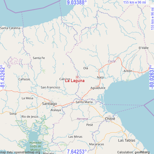
| Upper-left | 9.03388°, | -81.43262° |
| Center: | 8.33882°, | -80.72949° |
| Lower-right: | 7.64253°, | -80.02637° |
| Map W x H: | 154.7×154.7 km | = 96.1×96.1mi |
| max Lat: | 9.60898° ⇑64.4% North |
| La Laguna: | 8.33882° |
| min Lat: | ⇓35.6% South 7.26534° |
| min Long | La Laguna | max Long |
| -82.91275° | -80.72949° | -77.38965° |
| W 44.7%⇐ | ⇒55.3% E |
Elevation
Elevation of La Laguna is 142 m = 466 ft, and this is 30.1 m = 99 ft below average elevation for this country.
| Max E: |
2103 m = 6900 ft | 31.7% |
| Avg. | 172.1 m = 565 ft | |
| La Laguna | 142 m = 466 ft | |
Min E: |
-1 m = -3 ft | 68.3% |
See also: Panama elevation on elevation.city.
Geographical zone
La Laguna is located in North Torrid zone (between Equator and Tropic of Cancer). Distance of Equator is 927.2 km =576.1 mi to South.| Distance of | km | miles | from La Laguna |
|---|---|---|---|
| North Pole | 9079.9 | 5642 | to North |
| Arctic Circle | 6474 | 4022.8 | to North |
| Tropic Cancer | 1678.7 | 1043.1 | to North |
| Equator | 927.2 | 576.1 | to South |


Nearby cities:
15 places around La Laguna: (largest is in red/bold)
• Barnizal
9 km =5.6 mi,  324°
324°
• Barranco Colorado
11.8 km =7.3 mi,  61°
61°
• Calobre
12.4 km =7.7 mi,  259°
259°
• El Copé
12.3 km =7.6 mi,  26°
26°
• El Cortezo
15.7 km =9.8 mi,  87°
87°
• El Cristo
15.4 km =9.6 mi,  129°
129°
• El Potrero
8.3 km =5.2 mi,  300°
300°
• Las Guías Abajo
16.3 km =10.1 mi,  189°
189°
• Las Huacas del Quije
14.4 km =8.9 mi,  350°
350°
• Llano Sánchez
15.8 km =9.8 mi,  170°
170°
• Monjarás
15.5 km =9.6 mi,  282°
282°
• Olá
12.3 km =7.6 mi,  44°
44°
• Salitrosa
17.4 km =10.8 mi,  144°
144°
• San José
16.5 km =10.3 mi,  329°
329°
• Toza
9.9 km =6.2 mi, 85°
Sources, notices
• [Note1] Compared only with cities in Panama existing in our database
• [Src1] Map data: © OpenStreetMap contributors (CC-BY-SA)
• [Src2] Other city data from geonames.org with taken over terms of usage.
• [Src3] Geographical zone / Annual Mean Temperature by Robert A. Rohde @ Wikipedia
