Olá geodata
Olá (Coclé) is a seat of a second-order administrative division; located in Panama in America/Panama (GMT-5) time zone. With population of 384 people, there are 526 cities with bigger population in this country. Compared to other cities in Panama, 56% of cities are located further ↑North; 53.4% of cities are located further →East and 66.4% of cities have lower elevation than Olá. Note1


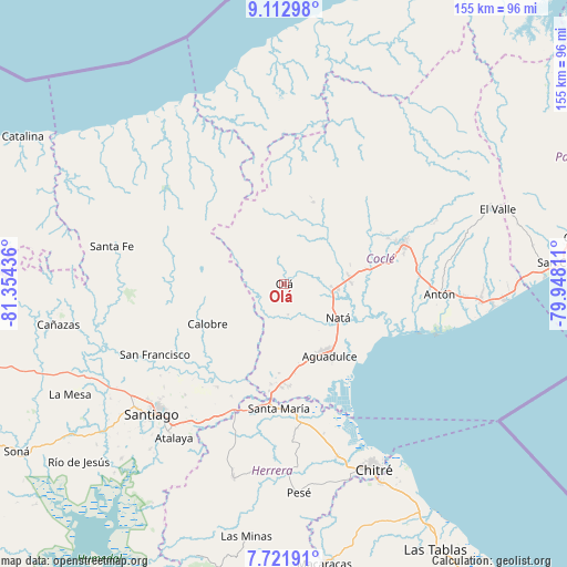
Olá GPS coordinates[2]
8° 25' 5.052" North, 80° 39' 4.428" West
| Map corner | latitude | longitude |
|---|---|---|
| Upper-left | 9.11298°, | -81.35436° |
| Center: | 8.41807°, | -80.65123° |
| Lower-right: | 7.72191°, | -79.94811° |
| Map W x H: | 154.7×154.7 km | = 96.1×96.1mi |
| max Lat: | 9.60898° ⇑56% North |
| Olá: | 8.41807° |
| min Lat: | ⇓44% South 7.26534° |
| min Long | Olá | max Long |
| -82.91275° | -80.65123° | -77.38965° |
| W 46.6%⇐ | ⇒53.4% E |
Elevation
Elevation of Olá is 129 m = 423 ft, and this is 43.1 m = 141 ft below average elevation for this country.
| Max E: |
2103 m = 6900 ft | 33.6% |
| Avg. | 172.1 m = 565 ft | |
| Olá | 129 m = 423 ft | |
Min E: |
-1 m = -3 ft | 66.4% |
See also: Panama elevation on elevation.city.
Geographical zone
Olá is located in North Torrid zone (between Equator and Tropic of Cancer). Distance of Equator is 936 km =581.6 mi to South.| Distance of | km | miles | from Olá |
|---|---|---|---|
| North Pole | 9071.1 | 5636.5 | to North |
| Arctic Circle | 6465.2 | 4017.3 | to North |
| Tropic Cancer | 1669.9 | 1037.6 | to North |
| Equator | 936 | 581.6 | to South |


Nearby cities:
15 places around Olá: (largest is in red/bold)
• Barnizal
14 km =8.7 mi,  263°
263°
• Barranco Colorado
3.6 km =2.2 mi,  151°
151°
• Capellanía
17 km =10.6 mi,  141°
141°
• Churubé Abajo
12.3 km =7.6 mi,  100°
100°
• El Caño
14.8 km =9.2 mi, 96°
• El Copé
3.8 km =2.4 mi,  305°
305°
• El Cortezo
10.7 km =6.6 mi, 138°
• El Potrero
16.4 km =10.2 mi,  253°
253°
• Guzman
13.5 km =8.4 mi,  33°
33°
• La Laguna
12.3 km =7.6 mi,  224°
224°
• Las Huacas del Quije
12.2 km =7.6 mi,  296°
296°
• Natá
17.3 km =10.7 mi,  123°
123°
• Nuestro Amo
7.4 km =4.6 mi,  66°
66°
• San José
17.8 km =11.1 mi,  287°
287°
• Toza
8.2 km =5.1 mi,  171°
171°
Sources, notices
• [Note1] Compared only with cities in Panama existing in our database
• [Src1] Map data: © OpenStreetMap contributors (CC-BY-SA)
• [Src2] Other city data from geonames.org with taken over terms of usage.
• [Src3] Geographical zone / Annual Mean Temperature by Robert A. Rohde @ Wikipedia
