El Toro geodata
El Toro (Herrera) is a seat of a third-order administrative division; located in Panama in America/Panama (GMT-5) time zone. With population of 176 people, there are 617 cities with bigger population in this country. Compared to other cities in Panama, 91.8% of cities are located further ↑North; 58.9% of cities are located further →East and 88.2% of cities have lower elevation than El Toro. Note1


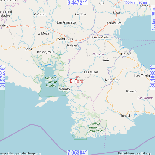
El Toro GPS coordinates[2]
7° 45' 3.96" North, 80° 52' 9.948" West
| Map corner | latitude | longitude |
|---|---|---|
| Upper-left | 8.44721°, | -81.57256° |
| Center: | 7.7511°, | -80.86943° |
| Lower-right: | 7.05384°, | -80.16631° |
| Map W x H: | 154.9×154.9 km | = 96.3×96.3mi |
| max Lat: | 9.60898° ⇑91.8% North |
| El Toro: | 7.7511° |
| min Lat: | ⇓8.2% South 7.26534° |
| min Long | El Toro | max Long |
| -82.91275° | -80.86943° | -77.38965° |
| W 41.1%⇐ | ⇒58.9% E |
Elevation
Elevation of El Toro is 399 m = 1309 ft, and this is 226.9 m = 744 ft above average elevation for this country.
| Max E: |
2103 m = 6900 ft | 11.8% |
| El Toro | 399 m 1309 ft | |
| Avg. | 172.1 m = 565 ft | |
Min E: |
-1 m = -3 ft | 88.2% |
See also: Panama elevation on elevation.city.
Geographical zone
El Toro is located in North Torrid zone (between Equator and Tropic of Cancer). Distance of Equator is 861.8 km =535.5 mi to South.| Distance of | km | miles | from El Toro |
|---|---|---|---|
| North Pole | 9145.2 | 5682.6 | to North |
| Arctic Circle | 6539.3 | 4063.3 | to North |
| Tropic Cancer | 1744.1 | 1083.7 | to North |
| Equator | 861.8 | 535.5 | to South |


Nearby cities:
15 places around El Toro: (largest is in red/bold)
• Cerro Largo
10.1 km =6.3 mi,  24°
24°
• Chumical
18.9 km =11.7 mi,  56°
56°
• El Barrito
24.8 km =15.4 mi,  339°
339°
• El Cedro
24.3 km =15.1 mi,  107°
107°
• La Carrillo
24.3 km =15.1 mi,  356°
356°
• Las Guabas
18.9 km =11.7 mi, 21°
• Las Minas
14.5 km =9 mi,  69°
69°
• Leones Arriba
3.1 km =1.9 mi, 58°
• Limón de Tijeras
8.8 km =5.5 mi,  326°
326°
• Los Cerros de Paja
22 km =13.7 mi,  99°
99°
• Ocú
23.3 km =14.5 mi,  25°
25°
• Ponuga
18.9 km =11.7 mi,  320°
320°
• Quebrada del Rosario
14.7 km =9.1 mi, 107°
• San José
22.5 km =14 mi,  6°
6°
• Tebario
12.7 km =7.9 mi,  250°
250°
Sources, notices
• [Note1] Compared only with cities in Panama existing in our database
• [Src1] Map data: © OpenStreetMap contributors (CC-BY-SA)
• [Src2] Other city data from geonames.org with taken over terms of usage.
• [Src3] Geographical zone / Annual Mean Temperature by Robert A. Rohde @ Wikipedia
