Cayo de Agua geodata
Cayo de Agua (Bocas del Toro) is a populated place; located in Panama in America/Panama (GMT-5) time zone. With population of 529 people, there are 463 cities with bigger population in this country. Compared to other cities in Panama, 89.2% of cities are located further ↓South; 79.1% of cities are located further →East and 99.4% of cities have higher elevation than Cayo de Agua. Note1


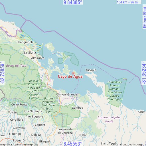
Cayo de Agua GPS coordinates[2]
9° 9' 1.332" North, 82° 3' 19.656" West
| Map corner | latitude | longitude |
|---|---|---|
| Upper-left | 9.84385°, | -82.75859° |
| Center: | 9.15037°, | -82.05546° |
| Lower-right: | 8.45553°, | -81.35234° |
| Map W x H: | 154.4×154.4 km | = 95.9×95.9mi |
| max Lat: | 9.60898° ⇑10.8% North |
| Cayo de Agua: | 9.15037° |
| min Lat: | ⇓89.2% South 7.26534° |
| min Long | Cayo de Agua | max Long |
| -82.91275° | -82.05546° | -77.38965° |
| W 20.9%⇐ | ⇒79.1% E |
Elevation
Elevation of Cayo de Agua is 3 m = 10 ft, and this is 169.1 m = 555 ft below average elevation for this country.
| Max E: |
2103 m = 6900 ft | 99.4% |
| Avg. | 172.1 m = 565 ft | |
| Cayo de Agua | 3 m = 10 ft | |
Min E: |
-1 m = -3 ft | 0.6% |
See also: Panama elevation on elevation.city.
Geographical zone
Cayo de Agua is located in North Torrid zone (between Equator and Tropic of Cancer). Distance of Equator is 1017.4 km =632.2 mi to South.| Distance of | km | miles | from Cayo de Agua |
|---|---|---|---|
| North Pole | 8989.6 | 5585.9 | to North |
| Arctic Circle | 6383.7 | 3966.6 | to North |
| Tropic Cancer | 1588.5 | 987 | to North |
| Equator | 1017.4 | 632.2 | to South |


Nearby cities:
15 places around Cayo de Agua: (largest is in red/bold)
• Bahía Azul
17.7 km =11 mi,  93°
93°
• Bastimentos
27.6 km =17.1 mi,  322°
322°
• Bocas del Toro
29.4 km =18.3 mi, 315°
• Cauchero
22.9 km =14.2 mi,  270°
270°
• Chiriquí Grande
23.8 km =14.8 mi,  196°
196°
• Isla Bastimentos
18.7 km =11.6 mi,  332°
332°
• Isla Tigre
3.9 km =2.4 mi,  314°
314°
• Kusapín
19 km =11.8 mi,  80°
80°
• Los Chiricanos
25.9 km =16.1 mi,  222°
222°
• Miramar
26.8 km =16.7 mi,  229°
229°
• Punta Laurel
7.9 km =4.9 mi,  262°
262°
• Punta Róbalo
24.8 km =15.4 mi,  239°
239°
• Rámbala
29 km =18 mi,  208°
208°
• San Cristóbal
27.5 km =17.1 mi,  302°
302°
• Tobobe
25.5 km =15.8 mi,  97°
97°
Sources, notices
• [Note1] Compared only with cities in Panama existing in our database
• [Src1] Map data: © OpenStreetMap contributors (CC-BY-SA)
• [Src2] Other city data from geonames.org with taken over terms of usage.
• [Src3] Geographical zone / Annual Mean Temperature by Robert A. Rohde @ Wikipedia
