Lagunas geodata
Lagunas (Loreto) is a seat of a third-order administrative division; located in Peru in America/Lima (GMT-5) time zone. With population of 9,197 people, there are 151 cities with bigger population in this country. Compared to other cities in Peru, 94.3% of cities are located further ↓South; 50.6% of cities are located further ←West and 88.4% of cities have higher elevation than Lagunas. Note1


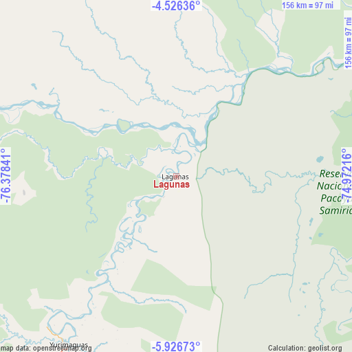
Lagunas GPS coordinates[2]
5° 13' 36.984" South, 75° 40' 31.008" West
| Map corner | latitude | longitude |
|---|---|---|
| Upper-left | -4.52636°, | -76.37841° |
| Center: | -5.22694°, | -75.67528° |
| Lower-right: | -5.92673°, | -74.97216° |
| Map W x H: | 155.7×155.7 km | = 96.7×96.7mi |
| max Lat: | -0.96667° ⇑5.7% North |
| Lagunas: | -5.22694° |
| min Lat: | ⇓94.3% South -18.01465° |
| min Long | Lagunas | max Long |
| -81.30472° | -75.67528° | -69.04167° |
| W 50.6%⇐ | ⇒49.4% E |
Elevation
Elevation of Lagunas is 124 m = 407 ft, and this is 2194.7 m = 7200 ft below average elevation for this country.
| Max E: |
5022 m = 16476 ft | 88.4% |
| Avg. | 2318.7 m = 7607 ft | |
| Lagunas | 124 m = 407 ft | |
Min E: |
1 m = 3 ft | 11.6% |
See also: Peru elevation on elevation.city.
Geographical zone
Lagunas is located in South Torrid zone (between Equator and Tropic of Capricorn). Distance of Equator is 581.2 km =361.1 mi to North.| Distance of | km | miles | from Lagunas |
|---|---|---|---|
| Equator | 581.2 | 361.1 | to North |
| Tropic Capricorn | 2024.7 | 1258.1 | to South |
| Antarctic Circle | 6820 | 4237.8 | to South |
| South Pole | 9425.9 | 5857 | to South |


Nearby cities:
15 places around Lagunas: (largest is in red/bold)
• Barranca
119.2 km =74.1 mi,  291°
291°
• Barranquita
121.6 km =75.6 mi,  198°
198°
• Bretaña
154.2 km =95.8 mi,  91°
91°
• Chazuta
157.9 km =98.1 mi, 198°
• Concordia
123.1 km =76.5 mi,  53°
53°
• Jeberos
67.6 km =42 mi,  264°
264°
• Navarro
123.3 km =76.6 mi,  183°
183°
• Parinari
155.9 km =96.9 mi,  61°
61°
• Pelejo
111.2 km =69.1 mi,  188°
188°
• San Antonio
147.1 km =91.4 mi,  210°
210°
• San Lorenzo
112.1 km =69.7 mi, 294°
• Santa Cruz
38.5 km =23.9 mi, 201°
• Santa Isabel
141.6 km =88 mi,  115°
115°
• Shucushuyacu
89.9 km =55.9 mi, 192°
• Yurimaguas
89.9 km =55.9 mi, 213°
Sources, notices
• [Note1] Compared only with cities in Peru existing in our database
• [Src1] Map data: © OpenStreetMap contributors (CC-BY-SA)
• [Src2] Other city data from geonames.org with taken over terms of usage.
• [Src3] Geographical zone / Annual Mean Temperature by Robert A. Rohde @ Wikipedia
