Saquena geodata
Saquena (Loreto) is a populated place; located in Peru in America/Lima (GMT-5) time zone. With population of 4,362 people, there are 254 cities with bigger population in this country. Compared to other cities in Peru, 97% of cities are located further ↓South; 70% of cities are located further ←West and 89.2% of cities have higher elevation than Saquena. Note1


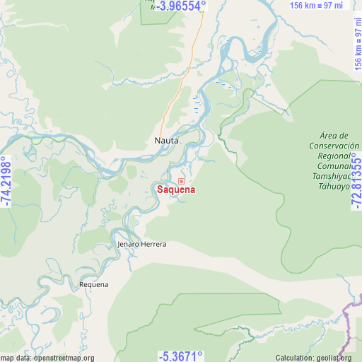
Saquena GPS coordinates[2]
4° 40' 0.012" South, 73° 31' 0.012" West
| Map corner | latitude | longitude |
|---|---|---|
| Upper-left | -3.96554°, | -74.2198° |
| Center: | -4.66667°, | -73.51667° |
| Lower-right: | -5.3671°, | -72.81355° |
| Map W x H: | 155.8×155.8 km | = 96.8×96.8mi |
| max Lat: | -0.96667° ⇑3% North |
| Saquena: | -4.66667° |
| min Lat: | ⇓97% South -18.01465° |
| min Long | Saquena | max Long |
| -81.30472° | -73.51667° | -69.04167° |
| W 70%⇐ | ⇒30% E |
Elevation
Elevation of Saquena is 105 m = 344 ft, and this is 2213.7 m = 7263 ft below average elevation for this country.
| Max E: |
5022 m = 16476 ft | 89.2% |
| Avg. | 2318.7 m = 7607 ft | |
| Saquena | 105 m = 344 ft | |
Min E: |
1 m = 3 ft | 10.8% |
See also: Peru elevation on elevation.city.
Geographical zone
Saquena is located in South Torrid zone (between Equator and Tropic of Capricorn). Distance of Equator is 518.9 km =322.4 mi to North.| Distance of | km | miles | from Saquena |
|---|---|---|---|
| Equator | 518.9 | 322.4 | to North |
| Tropic Capricorn | 2087 | 1296.8 | to South |
| Antarctic Circle | 6882.3 | 4276.5 | to South |
| South Pole | 9488.2 | 5895.7 | to South |


Nearby cities:
15 places around Saquena: (largest is in red/bold)
• Bretaña
108 km =67.1 mi,  231°
231°
• Concordia
140.8 km =87.5 mi,  274°
274°
• Genaro Herrera
31.6 km =19.6 mi,  212°
212°
• Iberia
131.5 km =81.7 mi, 212°
• Indiana
139.6 km =86.7 mi,  21°
21°
• Iquitos
106.1 km =65.9 mi, 15°
• Nauta
15.3 km =9.5 mi,  346°
346°
• Parinari
102.2 km =63.5 mi,  276°
276°
• Pebas
236.8 km =147.1 mi,  51°
51°
• Requena
57.3 km =35.6 mi,  220°
220°
• San Juan
87.1 km =54.1 mi,  356°
356°
• Santa Elena
164.4 km =102.2 mi,  202°
202°
• Santa Isabel
165 km =102.5 mi, 222°
• Tamanco
158.6 km =98.5 mi, 213°
• Trompeteros
195.5 km =121.5 mi,  299°
299°
Sources, notices
• [Note1] Compared only with cities in Peru existing in our database
• [Src1] Map data: © OpenStreetMap contributors (CC-BY-SA)
• [Src2] Other city data from geonames.org with taken over terms of usage.
• [Src3] Geographical zone / Annual Mean Temperature by Robert A. Rohde @ Wikipedia
