Genaro Herrera geodata
Genaro Herrera (Loreto) is a seat of a third-order administrative division; located in Peru in America/Lima (GMT-5) time zone. In our database, there are 305 cities with bigger population. Compared to other cities in Peru, 95.9% of cities are located further ↓South; 68.7% of cities are located further ←West and 88.9% of cities have higher elevation than Genaro Herrera. Note1


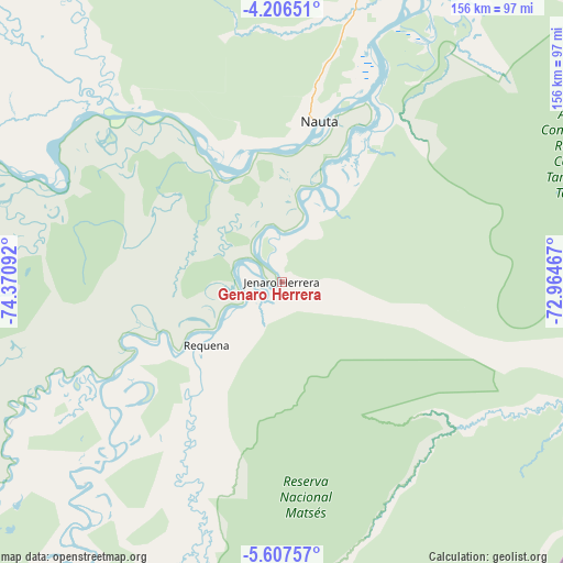
Genaro Herrera GPS coordinates[2]
4° 54' 26.676" South, 73° 40' 4.044" West
| Map corner | latitude | longitude |
|---|---|---|
| Upper-left | -4.20651°, | -74.37092° |
| Center: | -4.90741°, | -73.66779° |
| Lower-right: | -5.60757°, | -72.96467° |
| Map W x H: | 155.8×155.8 km | = 96.8×96.8mi |
| max Lat: | -0.96667° ⇑4.1% North |
| Genaro Herrera: | -4.90741° |
| min Lat: | ⇓95.9% South -18.01465° |
| min Long | Genaro Herrera | max Long |
| -81.30472° | -73.66779° | -69.04167° |
| W 68.7%⇐ | ⇒31.3% E |
Elevation
Elevation of Genaro Herrera is 112 m = 367 ft, and this is 2206.7 m = 7240 ft below average elevation for this country.
| Max E: |
5022 m = 16476 ft | 88.9% |
| Avg. | 2318.7 m = 7607 ft | |
| Genaro Herrera | 112 m = 367 ft | |
Min E: |
1 m = 3 ft | 11.1% |
See also: Peru elevation on elevation.city.
Geographical zone
Genaro Herrera is located in South Torrid zone (between Equator and Tropic of Capricorn). Distance of Equator is 545.7 km =339.1 mi to North.| Distance of | km | miles | from Genaro Herrera |
|---|---|---|---|
| Equator | 545.7 | 339.1 | to North |
| Tropic Capricorn | 2060.3 | 1280.2 | to South |
| Antarctic Circle | 6855.5 | 4259.8 | to South |
| South Pole | 9461.4 | 5879 | to South |


Nearby cities:
15 places around Genaro Herrera: (largest is in red/bold)
• Bretaña
79 km =49.1 mi,  239°
239°
• Concordia
129.3 km =80.3 mi,  287°
287°
• Iberia
99.9 km =62.1 mi,  212°
212°
• Indiana
170.8 km =106.1 mi,  23°
23°
• Iquitos
136.7 km =84.9 mi, 19°
• Lagunas
225.2 km =139.9 mi,  260°
260°
• Nauta
43.6 km =27.1 mi, 17°
• Parinari
92.9 km =57.7 mi, 294°
• Requena
26.5 km =16.5 mi,  229°
229°
• San Juan
114.2 km =71 mi,  5°
5°
• Santa Elena
133.4 km =82.9 mi,  200°
200°
• Santa Isabel
134 km =83.3 mi,  224°
224°
• Saquena
31.6 km =19.6 mi,  32°
32°
• Tamanco
127.1 km =79 mi, 214°
• Trompeteros
196.3 km =122 mi,  308°
308°
Sources, notices
• [Note1] Compared only with cities in Peru existing in our database
• [Src1] Map data: © OpenStreetMap contributors (CC-BY-SA)
• [Src2] Other city data from geonames.org with taken over terms of usage.
• [Src3] Geographical zone / Annual Mean Temperature by Robert A. Rohde @ Wikipedia
