San Juan geodata
San Juan (Loreto) is a seat of a third-order administrative division; located in Peru in America/Lima (GMT-5) time zone. In our database, there are 305 cities with bigger population. Compared to other cities in Peru, 98.8% of cities are located further ↓South; 69.6% of cities are located further ←West and 89.4% of cities have higher elevation than San Juan. Note1


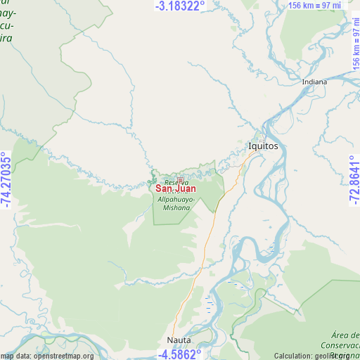
San Juan GPS coordinates[2]
3° 53' 6" South, 73° 34' 1.992" West
| Map corner | latitude | longitude |
|---|---|---|
| Upper-left | -3.18322°, | -74.27035° |
| Center: | -3.885°, | -73.56722° |
| Lower-right: | -4.5862°, | -72.8641° |
| Map W x H: | 156×156 km | = 96.9×96.9mi |
| max Lat: | -0.96667° ⇑1.2% North |
| San Juan: | -3.885° |
| min Lat: | ⇓98.8% South -18.01465° |
| min Long | San Juan | max Long |
| -81.30472° | -73.56722° | -69.04167° |
| W 69.6%⇐ | ⇒30.4% E |
Elevation
Elevation of San Juan is 99 m = 325 ft, and this is 2219.7 m = 7282 ft below average elevation for this country.
| Max E: |
5022 m = 16476 ft | 89.4% |
| Avg. | 2318.7 m = 7607 ft | |
| San Juan | 99 m = 325 ft | |
Min E: |
1 m = 3 ft | 10.6% |
See also: Peru elevation on elevation.city.
Geographical zone
San Juan is located in South Torrid zone (between Equator and Tropic of Capricorn). Distance of Equator is 432 km =268.4 mi to North.| Distance of | km | miles | from San Juan |
|---|---|---|---|
| Equator | 432 | 268.4 | to North |
| Tropic Capricorn | 2173.9 | 1350.8 | to South |
| Antarctic Circle | 6969.2 | 4330.5 | to South |
| South Pole | 9575.1 | 5949.7 | to South |


Nearby cities:
15 places around San Juan: (largest is in red/bold)
• Bretaña
172.9 km =107.4 mi,  207°
207°
• Concordia
154.7 km =96.1 mi,  240°
240°
• Genaro Herrera
114.2 km =71 mi,  185°
185°
• Iberia
208.4 km =129.5 mi,  198°
198°
• Indiana
71.5 km =44.4 mi,  53°
53°
• Iquitos
37.9 km =23.5 mi,  66°
66°
• Nauta
72.1 km =44.8 mi,  178°
178°
• Parinari
122.3 km =76 mi,  231°
231°
• Pebas
199.8 km =124.1 mi, 71°
• Requena
134.5 km =83.6 mi, 193°
• San Antonio del Estrecho
188.1 km =116.9 mi,  32°
32°
• Santa Isabel
234.2 km =145.5 mi, 206°
• Saquena
87.1 km =54.1 mi, 176°
• Tamanco
233.7 km =145.2 mi, 200°
• Trompeteros
165.6 km =102.9 mi,  272°
272°
Sources, notices
• [Note1] Compared only with cities in Peru existing in our database
• [Src1] Map data: © OpenStreetMap contributors (CC-BY-SA)
• [Src2] Other city data from geonames.org with taken over terms of usage.
• [Src3] Geographical zone / Annual Mean Temperature by Robert A. Rohde @ Wikipedia
