Iberia geodata
Iberia (Loreto) is a seat of a third-order administrative division; located in Peru in America/Lima (GMT-5) time zone. In our database, there are 305 cities with bigger population. Compared to other cities in Peru, 92.1% of cities are located further ↓South; 64.9% of cities are located further ←West and 88.8% of cities have higher elevation than Iberia. Note1


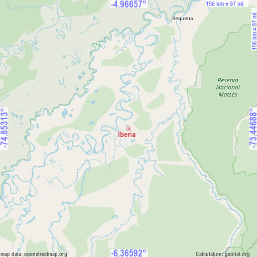
Iberia GPS coordinates[2]
5° 40' 0.012" South, 74° 9' 0" West
| Map corner | latitude | longitude |
|---|---|---|
| Upper-left | -4.96657°, | -74.85313° |
| Center: | -5.66667°, | -74.15° |
| Lower-right: | -6.36592°, | -73.44688° |
| Map W x H: | 155.6×155.6 km | = 96.7×96.7mi |
| max Lat: | -0.96667° ⇑7.9% North |
| Iberia: | -5.66667° |
| min Lat: | ⇓92.1% South -18.01465° |
| min Long | Iberia | max Long |
| -81.30472° | -74.15° | -69.04167° |
| W 64.9%⇐ | ⇒35.1% E |
Elevation
Elevation of Iberia is 116 m = 381 ft, and this is 2202.7 m = 7227 ft below average elevation for this country.
| Max E: |
5022 m = 16476 ft | 88.8% |
| Avg. | 2318.7 m = 7607 ft | |
| Iberia | 116 m = 381 ft | |
Min E: |
1 m = 3 ft | 11.2% |
See also: Peru elevation on elevation.city.
Geographical zone
Iberia is located in South Torrid zone (between Equator and Tropic of Capricorn). Distance of Equator is 630.1 km =391.5 mi to North.| Distance of | km | miles | from Iberia |
|---|---|---|---|
| Equator | 630.1 | 391.5 | to North |
| Tropic Capricorn | 1975.8 | 1227.7 | to South |
| Antarctic Circle | 6771.1 | 4207.4 | to South |
| South Pole | 9377 | 5826.6 | to South |


Nearby cities:
15 places around Iberia: (largest is in red/bold)
• Bretaña
46.9 km =29.1 mi,  341°
341°
• Concordia
141 km =87.6 mi,  330°
330°
• Genaro Herrera
99.9 km =62.1 mi,  32°
32°
• Lagunas
175.8 km =109.2 mi,  286°
286°
• Nauta
142.5 km =88.5 mi, 27°
• Navarro
191.8 km =119.2 mi,  247°
247°
• Orellana
177.3 km =110.2 mi,  219°
219°
• Parinari
126.3 km =78.5 mi,  345°
345°
• Requena
75.1 km =46.7 mi, 26°
• Santa Cruz
183 km =113.7 mi,  274°
274°
• Santa Elena
41.4 km =25.7 mi,  169°
169°
• Santa Isabel
42.1 km =26.2 mi, 254°
• Saquena
131.5 km =81.7 mi, 32°
• Shucushuyacu
192 km =119.3 mi,  258°
258°
• Tamanco
27.5 km =17.1 mi, 222°
Sources, notices
• [Note1] Compared only with cities in Peru existing in our database
• [Src1] Map data: © OpenStreetMap contributors (CC-BY-SA)
• [Src2] Other city data from geonames.org with taken over terms of usage.
• [Src3] Geographical zone / Annual Mean Temperature by Robert A. Rohde @ Wikipedia
